![]()
![]()
![]()
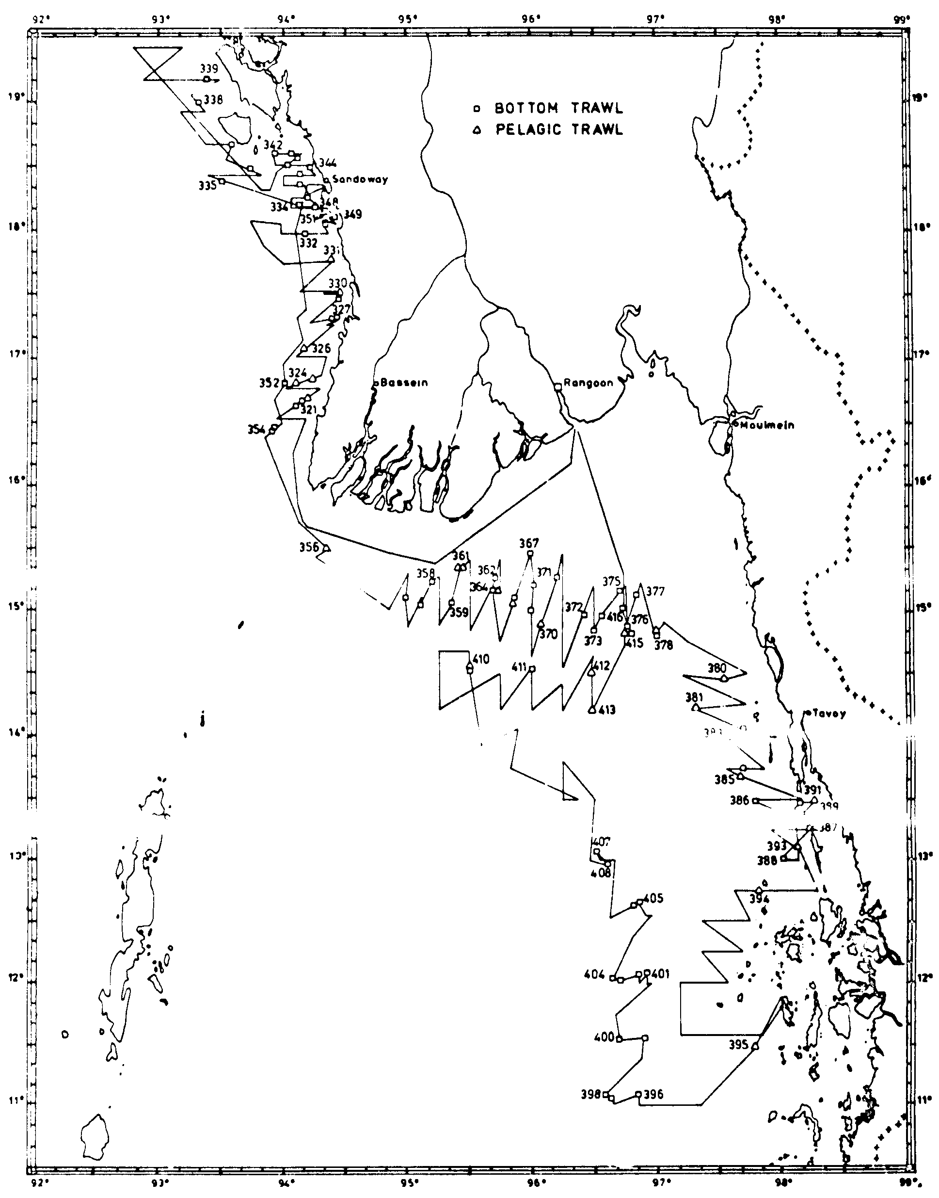
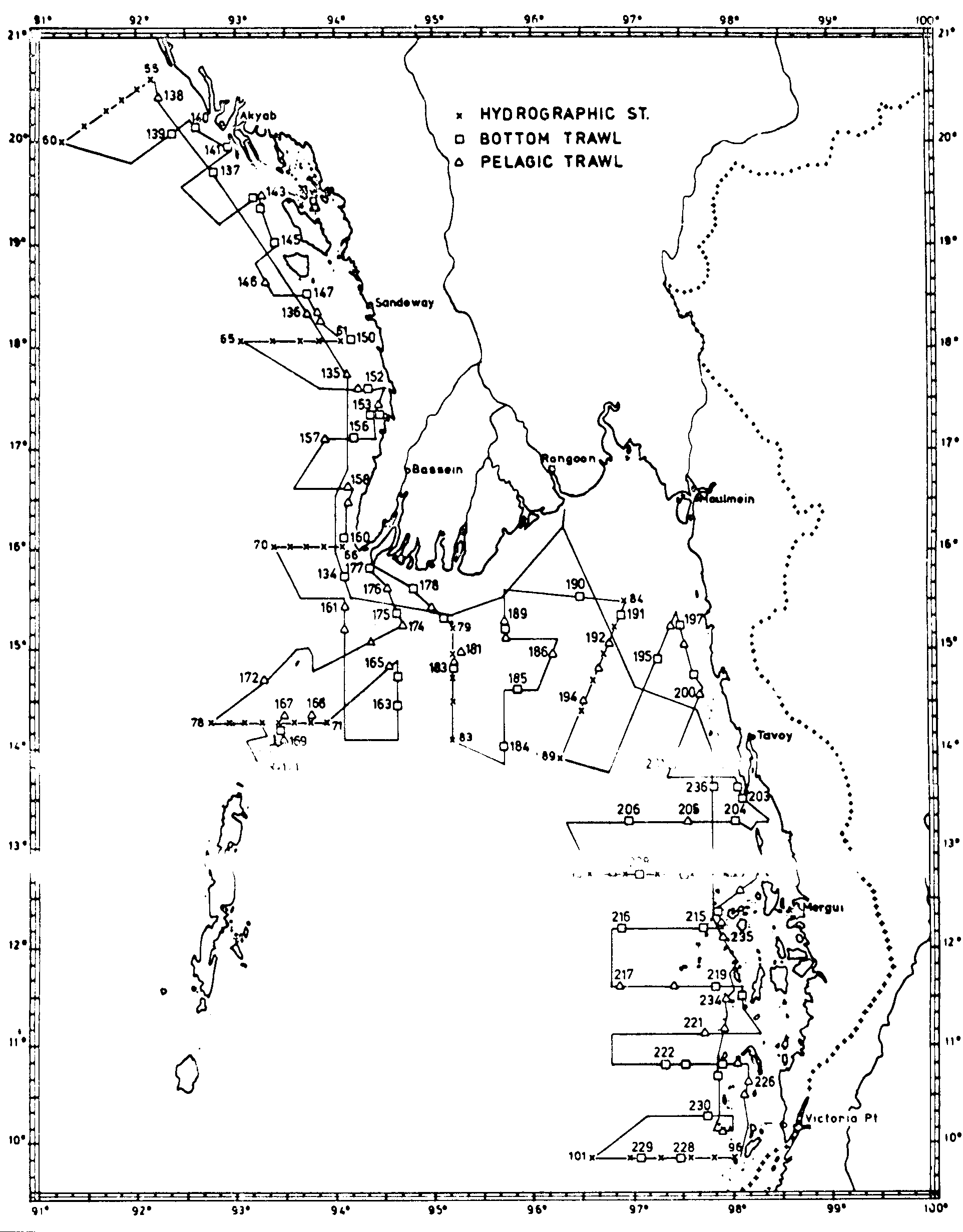
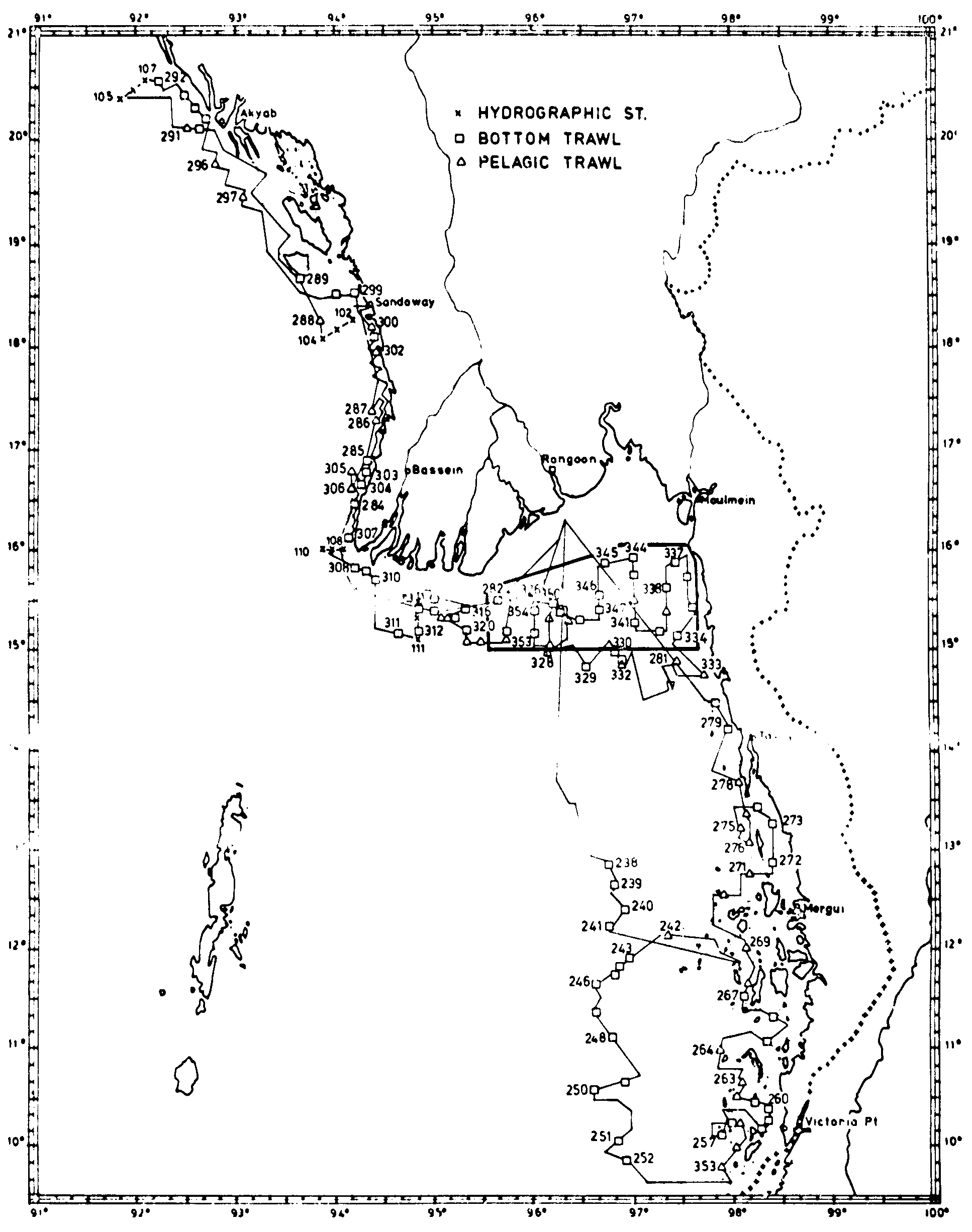
During each of the main surveys in the post-monsoon season in September-November 1979. and the pre-monsoon season in March-April 1980 the Burmese waters between the border with Bangladesh in the north and that with Thailand in the south was in principle covered twice. There was thus a total of four coverages as follows:
|
1st |
coverage |
25/9-18/10 |
1979 |
|
2nd |
coverage |
23/10 18/11 |
1979 |
|
3rd |
coverage |
5/3-1/4 |
1980 |
|
4th |
coverage |
5/4-27/4 |
1980 |
In the further analysis of the findings the total survey area will be divided into the following four geographical sub-areas which are likely also to represent main ecological divisions:
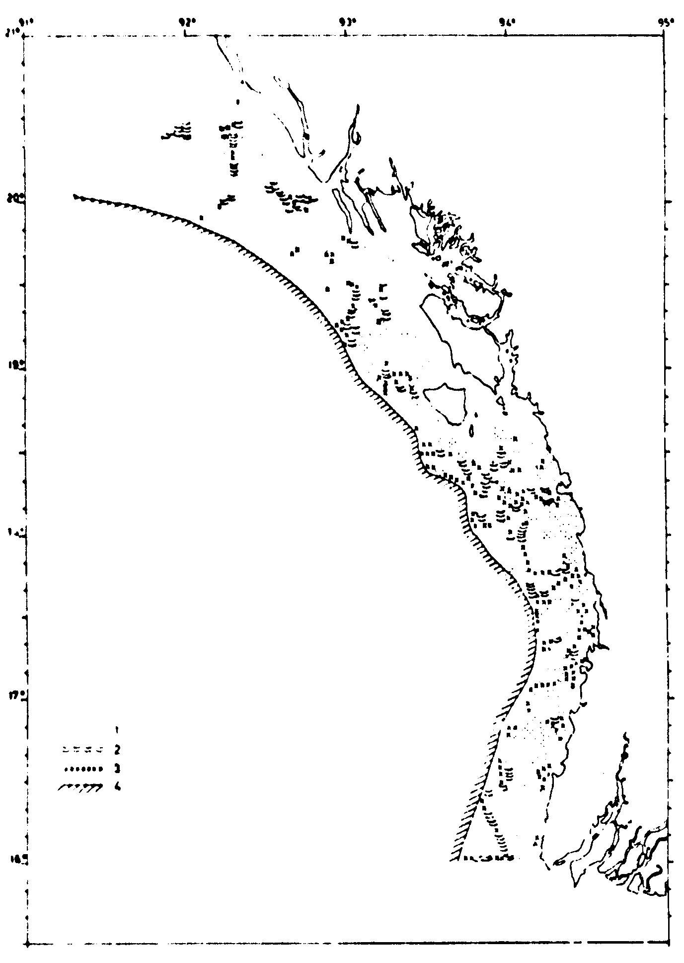
The Arakan coast, boardering the Bay of Bengal with a harrow shelf and few inlets down to about 16º Lat.N.Figure 1. Survey routes and stations 25 Sep-18 Oct 1979.The Delta area, covering the mostly shallow and slightly sloping wide shelf between 16º and 13º30' Lat.N. and about 94º to 98ºLong.E and dominated by the influence of the outflows of the Irrawaddy and the Salween rivers.
The Tenasserim coast, south of 13º30'N boardering the Andaman Sea, with numerous fjords and inlets and with shallow and medium depths ; and finally
The Deep Sea Trawling Ground on the slope of the shelf from 200 to 400 m depth off the Tenasserim coast, from abt 13ºLat.N to 10°Lat.N.
Figure 2 Survey routes and stations 23 Oct-18 Nov. 1979
Figure 3 Survey routes and stations 5 March-1 April 1980.
Although these sub-arears have been covered twice in each season all the observations and findings during one season have been analysed and interpreted jointly so that the results are presented as deriving from two surveys, one in the autumn, September-November 1970 and one in the spring, March-April 1980.
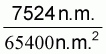
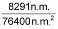
Estimates have been made of the area covered by the investigations. These are based on the distribution of the survey grids shown in Figures 1-4. Table 1 shows these estimates. Since the main fish distribution is limited to the shelf area, the parts of the shelf which was covered by the survey have also been calculated. The outer regions of the shelf (to the defined limit of 200 m depth) have generally been fully covered in a. sub-areas, but the inshore shallow parts could often not be covered because of a depth limit of about 15 m for safe operation of the vessel. Estimates have been made of the extent of the shallow inshore shelf which has been left uncovered in the various sub-areas. The estimates of the fish biomass will be adjusted for these areas which had to be left (...) of the surveys.
Table l. Area of investigation, degree of covering and shelf area in Burmese waters
|
Area of the investigations (nm2) |
Area of the shelf covered (nm2) |
Shallow waters not covered (nm2) |
Shelf area (nm2) |
||||
|
AREA |
Oct-Nov -80 |
Mai-Apr -80 |
Oct-Nov -79 |
Mar-Apr -80 |
Oct-Nov -79 |
Mai-Apr -80 |
|
|
Arakan court |
17.000 |
16.000 |
9.400 |
9.400 |
2.000 |
2.000 |
11.400 |
|
Delta area |
25.600 |
35.100 |
23.800 |
29.500 |
9.000 |
4.800 |
34.300 |
|
Tennasserim coast |
22.800 |
25.300 |
15.300 |
17.800 |
5.700 |
3.200 |
21.000 |
|
Total |
65.400 |
76.400 |
48.500 |
56.700 |
16.700 |
10.000 |
66.700 |
|
Autumn |
Spring |
|
|
|
![]()
![]()
![]()