![]()
![]()
![]()
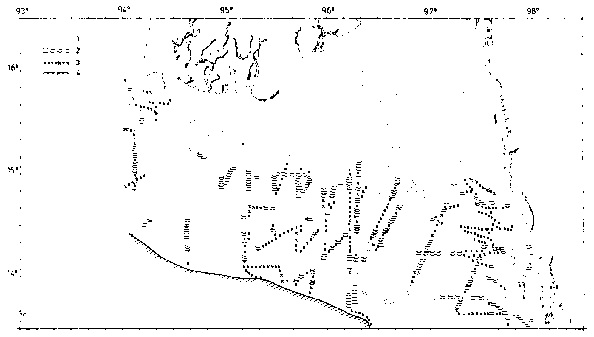
The type of bottom observed by echo sounder along the cruise tracks was classified according to its assumed suitability for bottom trawling as follows:
1. Even smooth bottom, suitable for all kinds of bottom trawls.Figures 5-7 show the total of observations regarding bottom conditions from all cruise tracks.
2. Generally smooth, but more uneven bottom where the use of bobbins would be preferable.
3. Rough bottom, unsuitable for trawling.
4. Very steep bottom, unsuitable for trawling.
Off the Arakan coast (Figure 5) the width of the shelf is only about 30-40 n.m. up till about Sandoway, but widens to about 60 n.m. off Akyab. Inside the shelf in waters of less than 100 m depth there are wide areas of good trawling ground, but these are in places interrupted by rocks and corals. North of Sandoway there are extensive inshore very shallow areas where only small boats can operate. The slope of the shelf off the Arakan coast is steep and rough and generally not suitable for trawling. In many places on this coastline isolated small rocks or mud volcanoes were observed in areas with even flat bottom. These irregularities could be detected by the sonar, so during bottom trawling the sonar was frequently used to map the bottom conditions ahead of the vessel in order to avoid gear damage.
The Delta area (Figure 6) is characterized by a wide band of shallow smooth and gently sloping bottom. At about 15°Lat.N the bottom deepens more markedly from 20-30 m down about 100 m and in this region which extends 40 to 60 n.m. southwards the bottom is variable with many areas of good trawling ground interrupted by more uneven or rough bottom.
The Tenasserim coast (Figure 7) offers a more varied picture. The shelf is very wide, the 200 m depth countour lies 60-100 n.m. offshore. The slope outside this shelf is not very steep down to about 400 m depth and thus a deep water ground with generally smooth bottom extends over a wide offshore area from about 13°Lat.N southwards to the border with Thailand. There are also extensive areas of trawlable bottom further in towards the archipelago. In between the islands and in the inlets bottom conditions vary greatly between even smooth trawl bottom and rough rocky grounds. There are also here extensive areas of shallow water where only small boats can navigate.
![]()
![]()
![]()