![]()
![]()
1. Introduction
2. Narrative
3. Hydrography
4. Fish distribution
5. Fishing experiments
6. Distribution of report and data
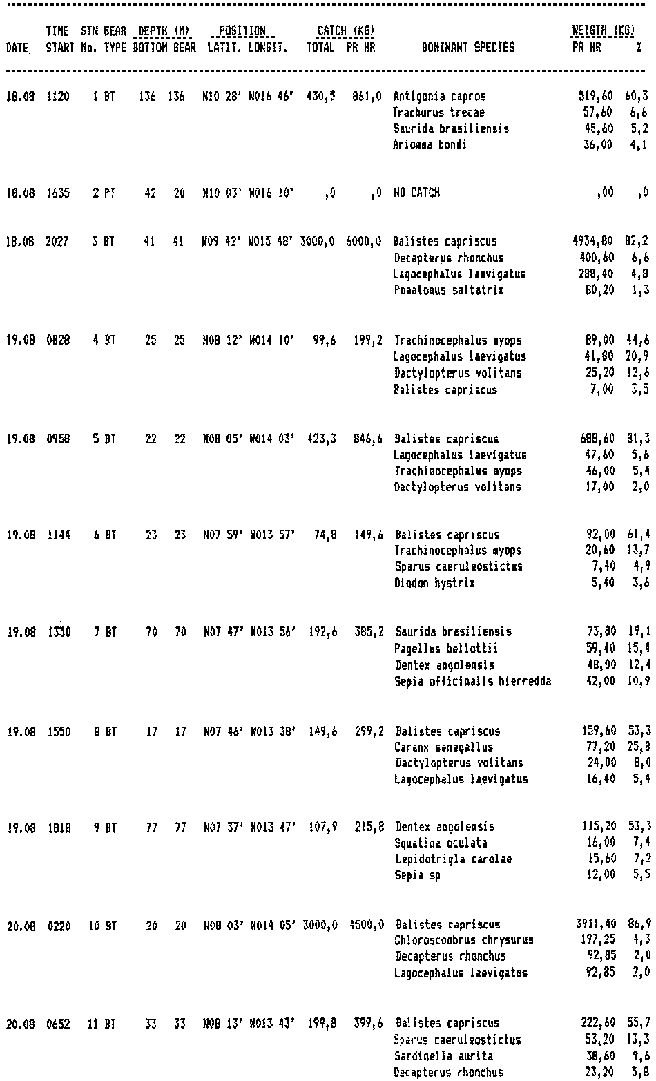
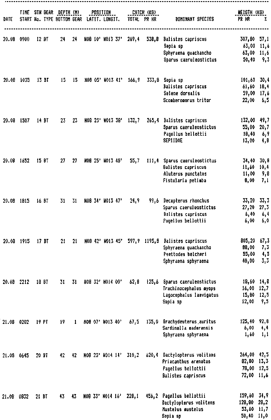
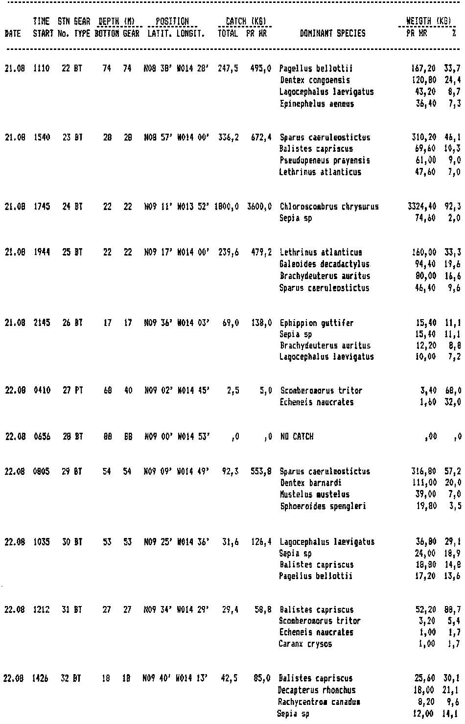
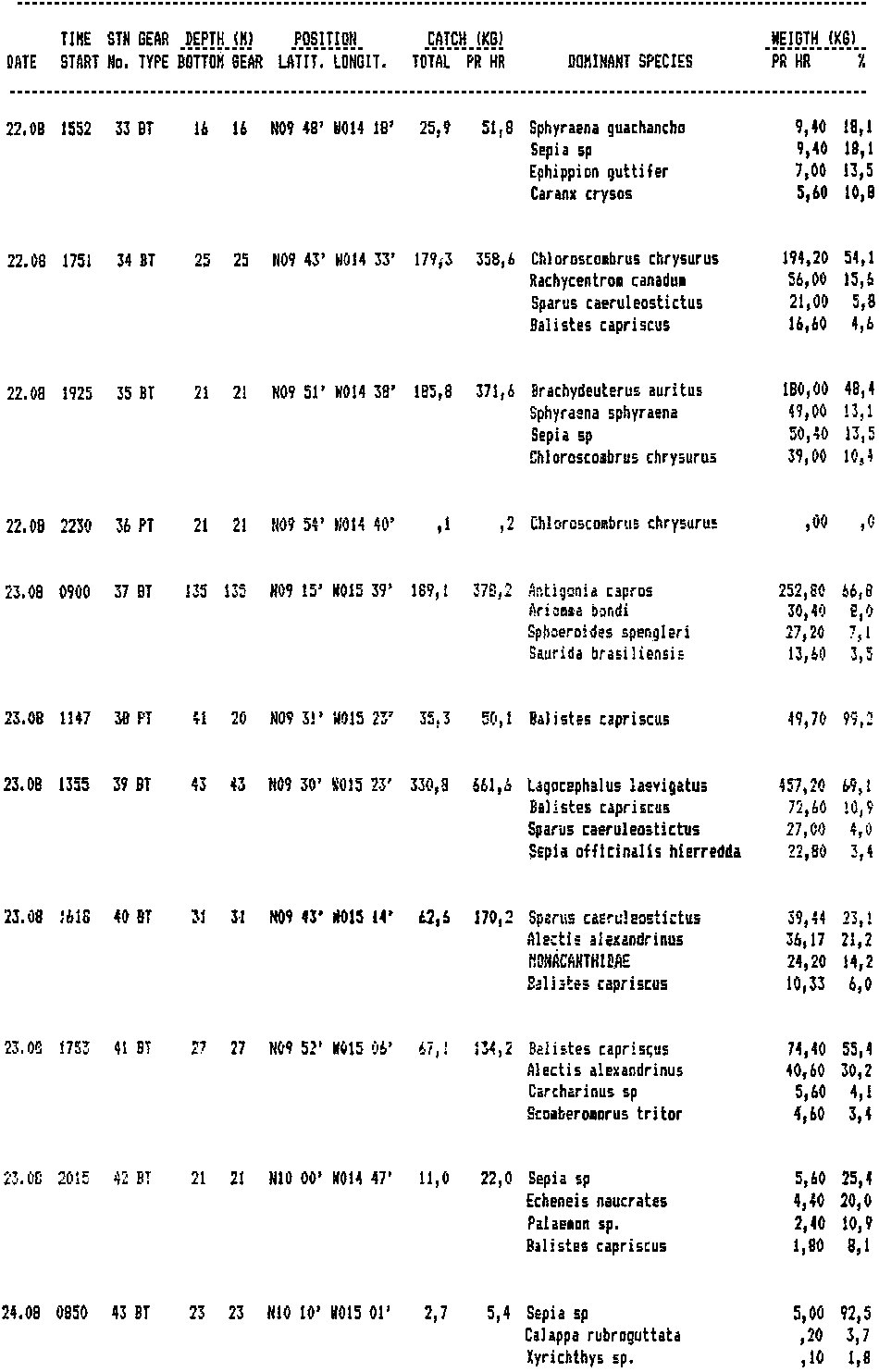
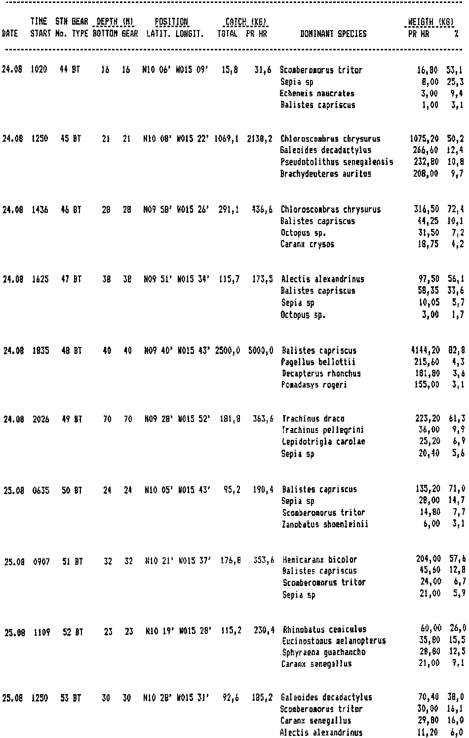
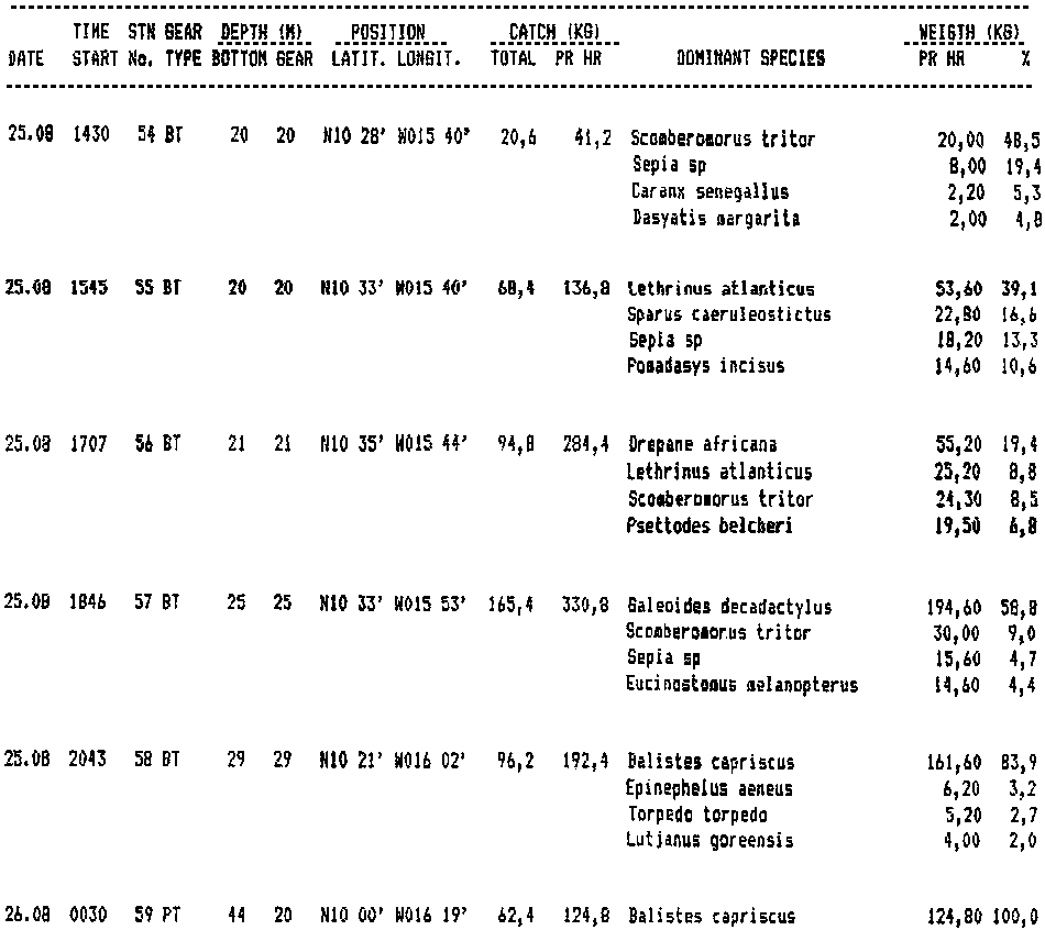
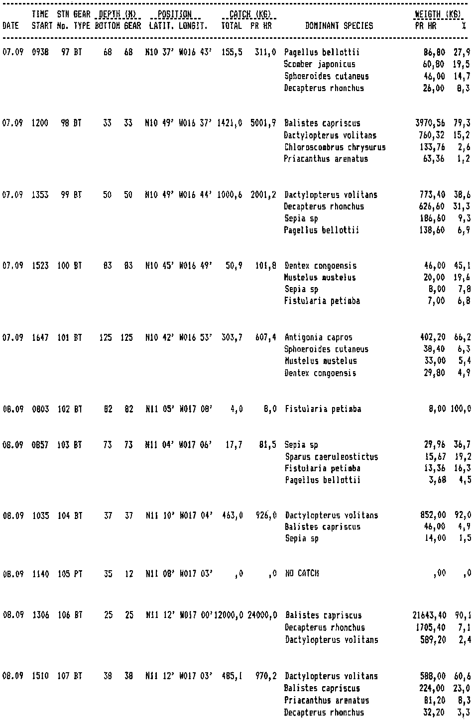
APPENDIX I: Abbreviated records of fishing stations
APPENDIX II: Pooled frequency distributions of length of common species
Task: The agreed work task for this first part of the vessels programme in the Cooperative Survey was to cover the shelf area from the Sherbro Island to Cape Roxo with an acoustic fishing survey for main pelagic species and conduct a bottom trawl survey of selected areas. Because of the delayed refit of the vessel at the St Cruz yard there was not sufficient time to complete the survey up to Cape Roxo before the intercalibration exercise off Senegal starting 28 August, and the remaining work off Guinea Bissau was deferred to the period 10-12 September.
Survey plan: For the acoustic survey a coverage of the Same type and intensity as that made of this area with the vessel in February 1982 was intended. Tracks were spaced 20 n m over the mid part of the banks where the widespread distribution of Balistes was expected. More intensive coverage was provided near the coast and along the shelf edge. In addition to fishing stations for identification of the echo records, a programme of prelocated trawl hauls was worked for faunistic studies and swept area estimates of biomass. Most of these stations were located over the inner parts of the shelf which mainly was worked during day-time.
Scientific staff:
From the CECAF countries the following participated:
Sierra Leone: P.A.T. Showers, I.E. Bangura.The vessels own scientific staff were: G. Saetersdal, A. Abella, O. Alvheim, T. Haugland, and E. Molvaer.
Guinea: S. Kouyate, Cheik Ahmed Bangura.
Guinea - Bissau A.P.J. Da Silva.
Gambia: J. Ndene.
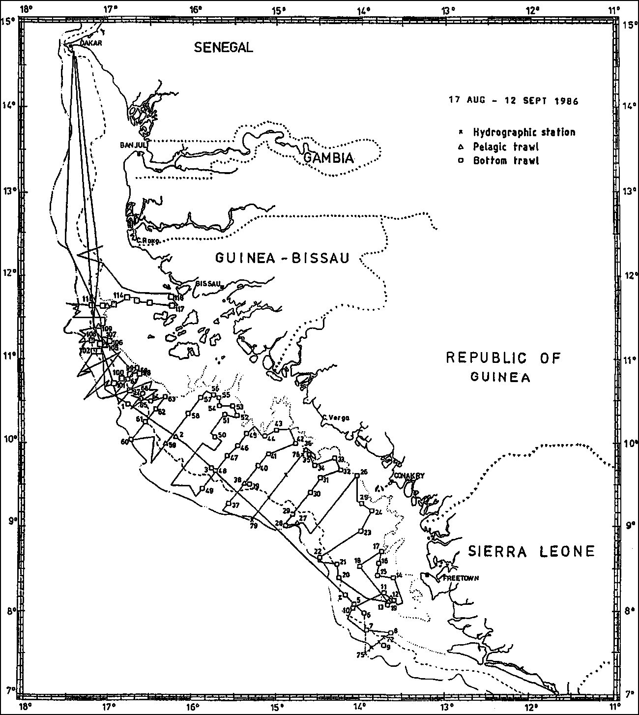
The survey tracks and fishing stations worked are shown in Figure 1. When steaming south after departure from Dakar on August 17 the shelf was followed so that a track along the banks was obtained. The distribution of work on the EEZ's of the various countries was as follows:
|
Sierra Leone: |
Aug 19-21, 300 nm sailed, 17 fishing stations |
|
Guinea: |
Aug 21-25, 800 nm sailed, 32 fishing stations |
|
Guinea-Bissau: |
Aug 25-27, 590 nm sailes, 19 fishing stations |
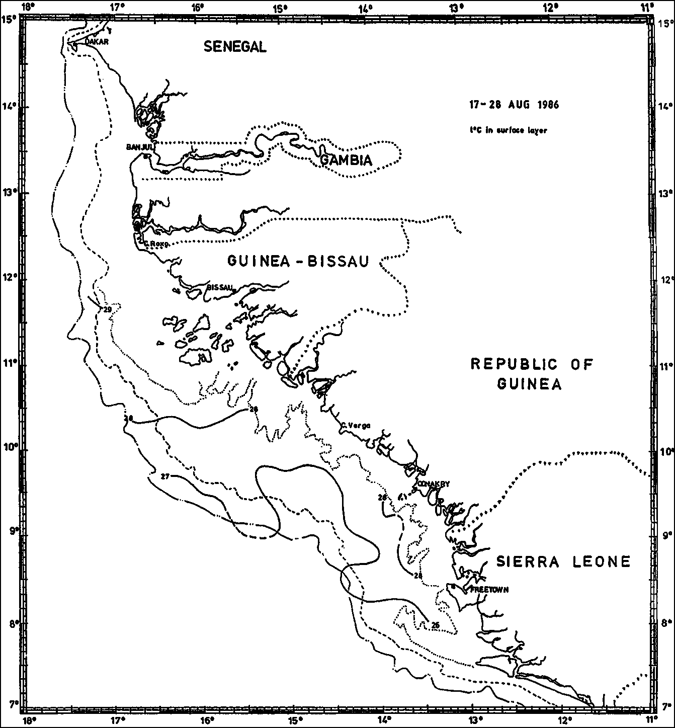
Figure 2 shows the horizontal temperature distribution of the surface layer based on the vessel's thermograph. In general the values correspond with those from satelite SST charts. Figure 3 shows temperature, salinity and oxygen in the profiles Sherbro Island - SW and Cape Verga - SW. The features appear to be normal for the season.
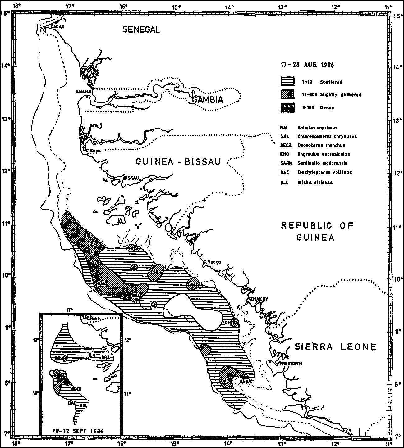
Figure 4 illustrates the distribution of all fish based on the observations of acoustic index of abundance. The units of the index is 0.1 x m2 per nm2.
The following features are noteworthy:
The concentration in the southernmost part of the survey area off Freetown consisted of rather loose formations of Balistes and of dense schools of sardinella further in. A Soviet purse seine fleet with motherships worked in the sardinella area. A proper acoustic coverage could not be made of the sardinella area as it seemed to extend onto the shallow St. Ann's Shoals.
In several locations inshore along the coast of Guinea relatively dense school areas were found containing Chloroscombrus chrysus in mixture with other carangids and with demersal fish.
A distribution of medium abundance of fish was found over the middle and outer parts of the shelf from northern Guinea into Guinea-Bissau up past the Bissagos Islands. This consisted of relatively loose formations of Balistes, but on the inner parts of the shelf off the Bissagos Islands school areas were located containing dense schools of false scad Decapterus rhonchus and of Chloroscombrus chrysurus.
The main features of the fish distribution found during this survey is similar to those of the 1981-82 surveys. The trigger fish, Balistes seems, however, to appear in much looser formations than found previously. An estimate of the total biomass of the fish observed over the shelf from Freetown to Cape Roxo gives a total of 445 000 tons. Of this Balistes represents some 300 000 tons. This is about 1/3 of the biomass estimates obtained during the "Dr. Fridtjof Nansen" surveys in 1981/82 and even below "Capricone's" estimates of 440 000 tons from 1978/79.
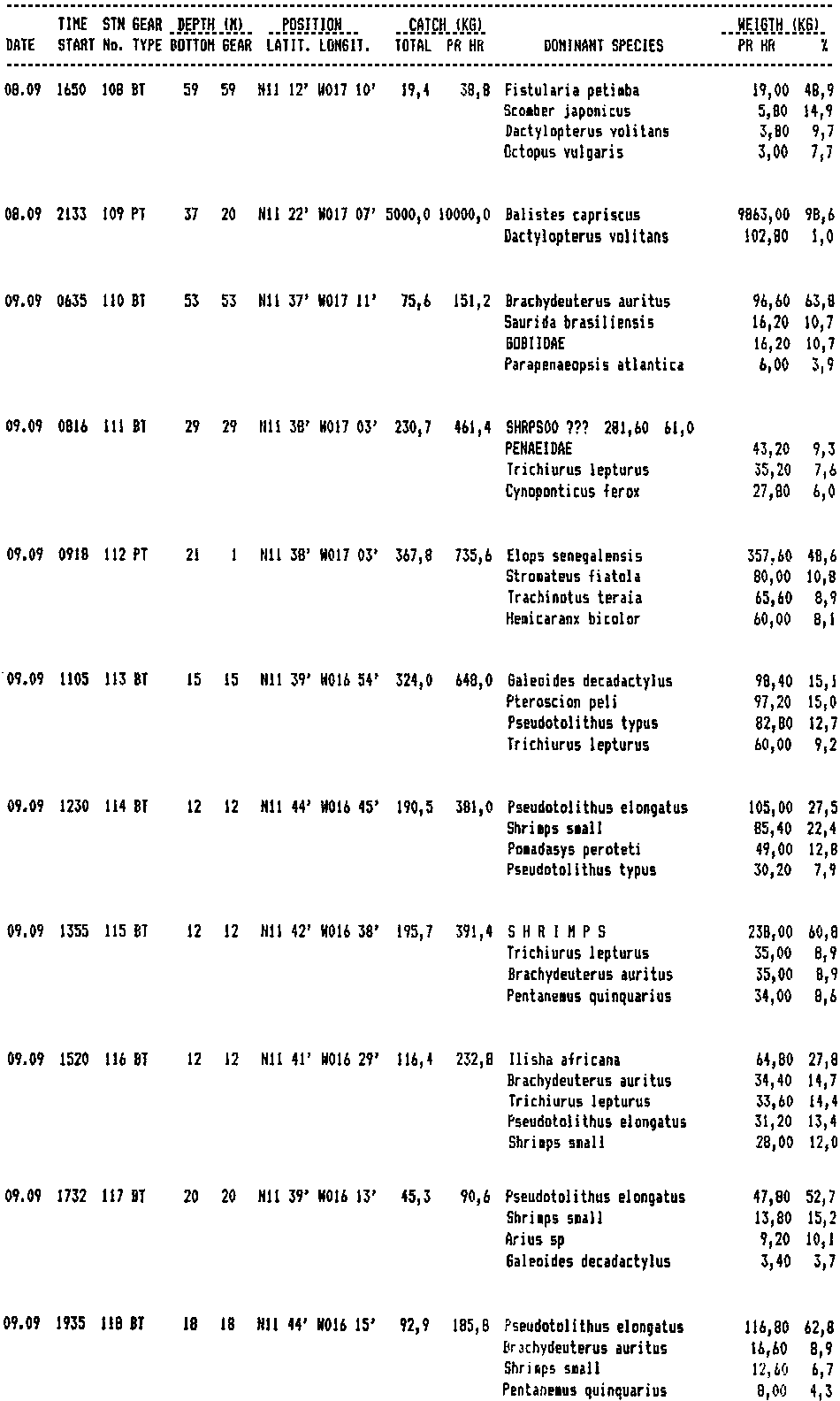
Most of the bottom trawl stations formed part of the programme of prelocated hauls for swept area estimates of demersal fish. The catch rate bear no relation to those that may be obtained in commercial fisheries. Appendix I gives the record of fishing stations with the four most important species only included.
Length sampling was made of all common species in the catches. Appendix II shows pooled unweighted data of a selection of common species.
This preliminary report is distributed to all participants and to the CECAF Secretariate. The participants from Sierra Leone and Guinea have also received full write-outs of the records of the fishing stations from their EEZ's and pooled length frequency distributions of all samples from these stations.
Figure 1. Survey tracks and fishing stations.
Figure 2. Distribution of surface temperature.
Figure 3. Temperature, salinity and oxygen in the profiles off Sherbo Island and Cape Roxo.
CAPE VERGA - SW
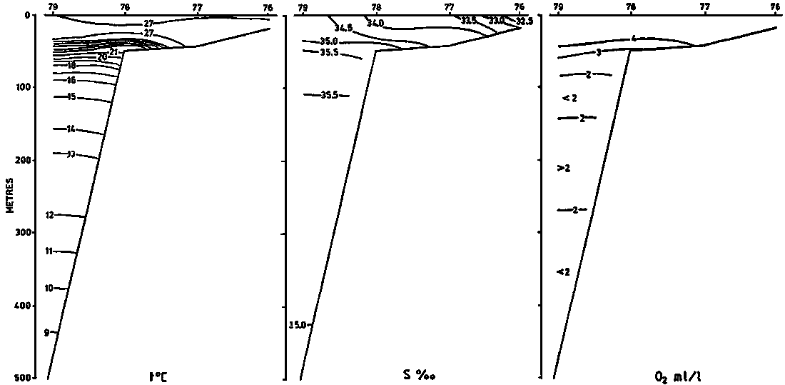
SHERBRO ISLAND - SW
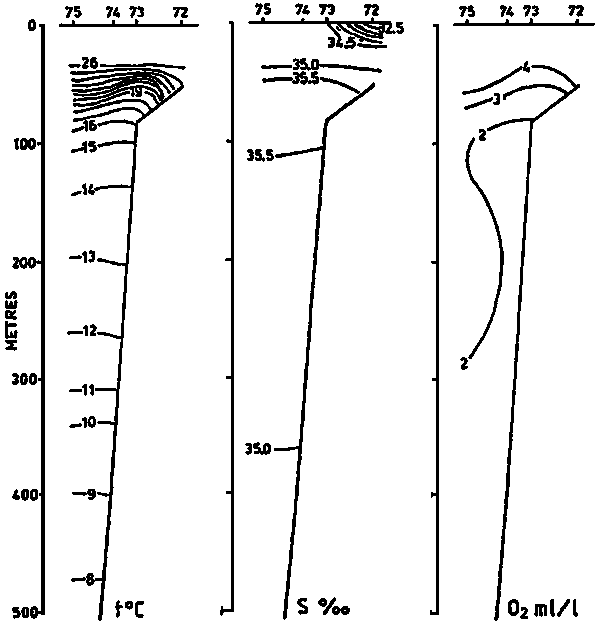
Figure 4. Fish distribution from acoustic abundance index.
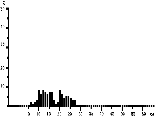
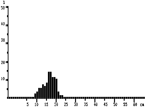
Balistes capriscus (pooled data)
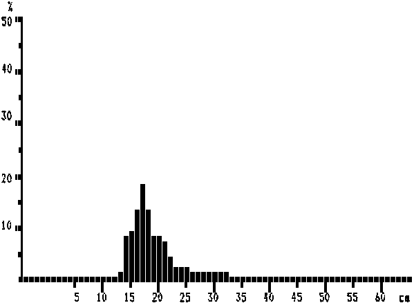
MEAN LENGTH = 18,5 cm N = 2550
Modes:, 17 cm, 32 cm
NUMBER OF SUBSAMPLES: 49
LOWEST STATION: 1
HIGHEST STATION: 68
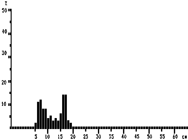
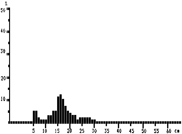
Chloroscombrus chrysurus (pooled data)
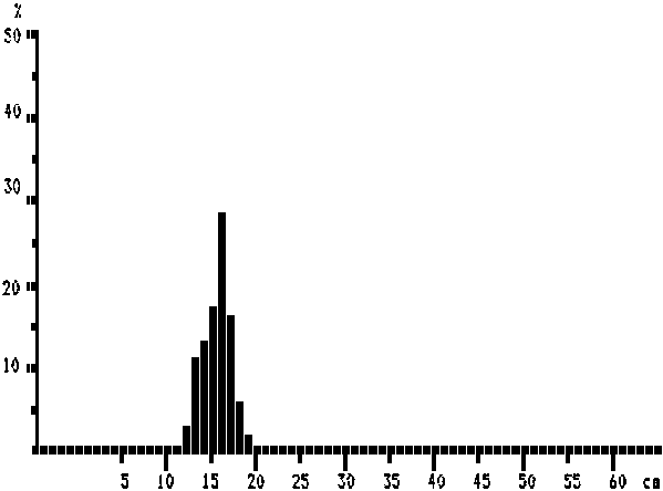
MEAN LENGTH = 15,9 cm N = 816
Modes:, 16 cm
NUMBER OF SUBSAMPLES: 11
LOWEST STATION: 1
HIGHEST STATION: 68
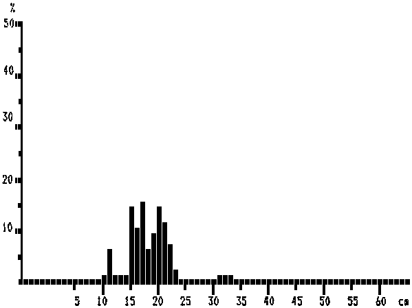
Decapterus rhonchus (pooled data)
MEAN LENGTH = 16,4 cm N = 779
Modes:, 6 cm, 10 cm, 12 cm, 16 cm, 20 cm, 24 cm
NUMBER OF SUBSAMPLES: 20
LOWEST STATION: 1
HIGHEST STATION: 68
Decapterus punctatus (pooled data)
MEAN LENGTH = 11,5 cm N = 131
Modes:, 7 cm, 11 cm, 13 cm, 17 cm
NUMBER OF SUBSAMPLES: 8
LOWEST STATION: 1
HIGHEST STATION: 68
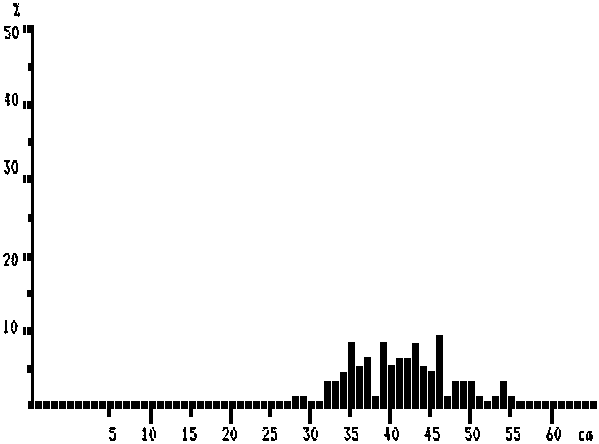
Scomberomorus tritor (pooled data)
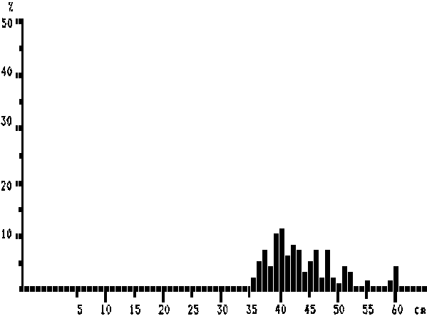
MEAN LENGTH = 43,2 cm N = 107
Modes:, 48 cm, 51 cm, 55 cm, 60 cm, 42 cm, 46 cm
NUMBER OF SUBSAMPLES: 18
LOWEST STATION: 1
HIGHEST STATION: 68
Selene dorsalis (pooled data)
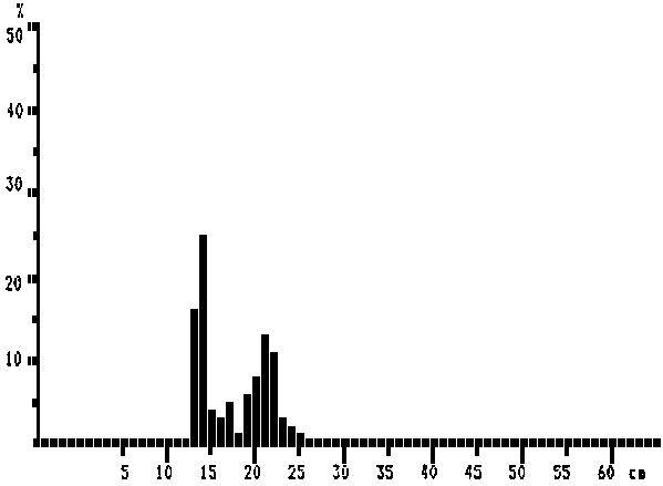
MEAN LENGTH = 17,3 cm N = 236
Modes:, 14 cm, 17 cm, 21 cm
NUMBER OF SUBSAMPLES: 5
LOWEST STATION: 1
HIGHEST STATION: 68
Pagellus bellottii (pooled data)
MEAN LENGTH = 16,1 cm N = 1191
Modes:, 13 cm, 17 cm
NUMBER OF SUBSAMPLES: 21
LOWEST STATION: 1
HIGHEST STATION: 68
Dentex angolensis (pooled data)
MEAN LENGTH = 18,0 cm N = 156
Modes:, 11 cm, 15 cm, 17 cm, 20 cm, 32 cm
NUMBER OF SUBSAMPLES: 3
LOWEST STATION: 1
HIGHEST STATION: 68
Sphyraena guachancho (pooled data)
MEAN LENGTH = 41,2 cm N = 77
Modes:, 49 cm, 54 cm, 37 cm, 39 cm, 43 cm, 46 cm
NUMBER OF SUBSAMPLES: 12
LOWEST STATION: 1
HIGHEST STATION: 68
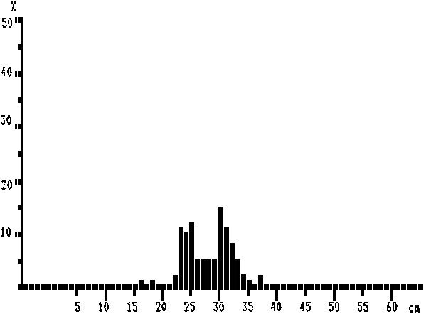
Caranx crysos (pooled data)
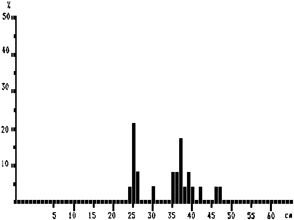
MEAN LENGTH = 33,8 cm N = 24
Modes:, 25 cm, 30 cm, 37 cm, 39 cm, 42 cm, 47 cm
NUMBER OF SUBSAMPLES: 7
LOWEST STATION: 1
HIGHEST STATION: 68
Caranx senegallus (pooled data)
MEAN LENGTH = 27,7 cm N = 131
Modes:, 16 cm, 18 cm, 23 cm, 25 cm, 30 cm, 37 cm
NUMBER OF SUBSAMPLES: 10
LOWEST STATION: 1
HIGHEST STATION: 68
Sparus caeruleosticus (pooled data)
MEAN LENGTH = 16,4 cm N = 810
Modes:, 6 cm, 16 cm, 26 cm
NUMBER OF SUBSAMPLES: 26
LOWEST STATION: 1
HIGHEST STATION: 68
![]()
![]()