- ➔ The presentation of case studies is an important means for exploring and demonstrating the potential of forest-sector innovation. Examples examined here showcase cutting-edge processes, tools and technologies in various regions and at various scales, providing evidence and knowledge and generating lessons that can be applied in diverse contexts worldwide. They are organized in three categories aligned with forest conservation, restoration and sustainable use.
- Innovations are assisting efforts to halt deforestation and maintain forests. These include a model for fostering multistakeholder governance to scale up integrated sustainable landscape management in Kenya and Nigeria; the use of new data on the role of forests in agricultural productivity to finance forest conservation in Brazil; harnessing the power of partnership and technological innovation to reduce commodity-driven forest loss in Ghana; the introduction of new tools and techniques in community forest management in Colombia; and combining science, technology and traditional knowledge to support Indigenous Peoples as forest custodians and enable locally led integrated fire management.
- Innovative approaches are bolstering the restoration of degraded lands and expanding agroforestry. They include developing a new national policy to better support agroforestry in India; integrating the socioeconomic objectives and nutritional needs of local communities with restoration to combat desertification in the Great Green Wall of the Sahara and the Sahel; the use of geospatial and other digital technologies to collate and disseminate restoration good practices and monitor progress in the implementation of the United Nations Decade on Ecosystem Restoration; enhancing the resilience of traditional water taro gardens in Vanuatu by incorporating new technologies, practices and plant varieties; improving the local governance of forest resources to deliver benefits for agriculture and forest restoration in Morocco and Tunisia; and a long-term project to link agroforestry with carbon trading in Mozambique.
- Innovations are helping to sustainably use forests and build green value chains. They include delivering collateral-free microfinance to small forest businesses through the power of collective organizations in Viet Nam; using new diagnostic tools and methodologies to catalyse legal-reform processes for sustainable wildlife management in 13 African countries; harnessing digital technologies to improve the efficiency of timber-tracking and promote sustainable supply chains in Guatemala; improving connectivity along timber supply chains to reduce waste and increase the viability of sustainable forest management in Brazil, Guyana, Panama and Peru; applying new wood-processing technologies in Slovenia and the United States of America to promote a bioeconomy and enhance earthquake resilience; and enabling farmer-led innovation in sustainable forest and agricultural production through Farmer Field Schools.
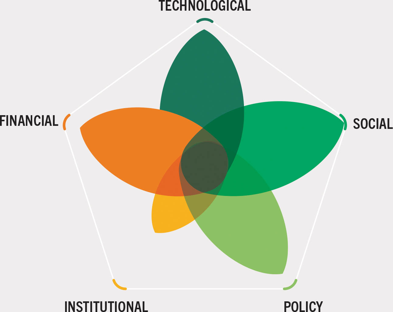
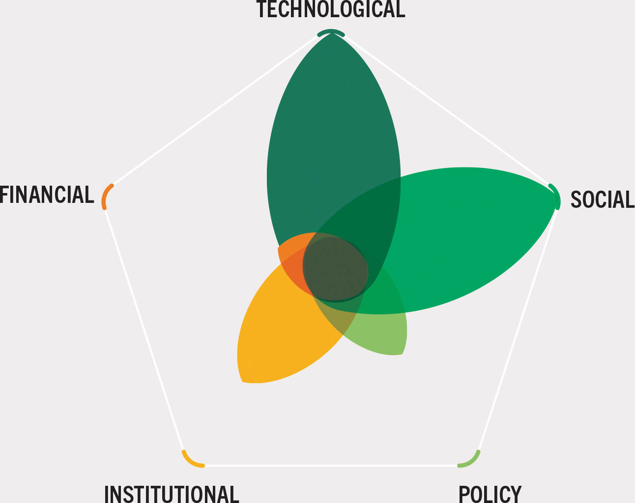
This chapter presents 18 case studies of forest-sector innovations drawn from submissions made by FAO staff and partner organizations on their work. They comprise a cross-section of cutting-edge processes, tools and technologies in various contexts globally, organized in three pathways: forest conservation, forest restoration, and sustainable forest use (although many contribute to two or three of the pathways). Each case study can be viewed as a bundle of innovations because each involves more than one innovation and innovation type (i.e. technological, social, policy, institutional and financial, as described in Table 3). For each case study, the authors have subjectively rated the relative importance of each type with a score of 1 to 10, represented illustratively with different-sized leaves.
4.1 Innovations are assisting efforts to halt deforestation and maintain forests
Halting deforestation would cut greenhouse-gas emissions significantly1,v while helping safeguard most of the Earth’s terrestrial biodiversity and maintain key ecosystem services. New science has illustrated the dramatic cooling effect of forests through a range of non-carbon biophysical processes such as evapotranspiration, albedo, aerosols and volatile organic compounds and estimates that tropical forest conservation could provide 20–40 percent more global cooling than previously thought.195 This additional mitigation of climate effects is complemented by the role of forests in regulating rainfall and stabilizing local to more-distant climates, thereby helping minimize extreme weather and making forests essential for climate-change adaptation and resilience. Future agricultural productivity, especially in the tropics, depends partly on the climate regulatory services that forests provide.
Global, regional and national efforts to halt deforestation and maintain the world’s forests have produced a proliferation of innovations, such as major advances in real-time forest monitoring to enable REDD+ results-based payments and the growth of forest carbon markets. Advances have also been made in the traceability of key commodities towards deforestation-free production, as well as policy innovations to bridge sectors through integrated landscape approaches. Improved understanding of the key forest stewardship roles played by Indigenous Peoples and local communities has fostered innovations towards greater inclusion in policymaking and forest finance.
The following six case studies present innovations aimed at increasing the quality of, and access to, forest-monitoring data and improving land-use planning and management as means for halting deforestation and maintaining forests.
Case study 1Fostering multistakeholder governance mechanisms to scale up integrated sustainable landscape management
Location: Kenya, Nigeria
Partners: FAO, Global Environment Facility (GEF), Kenya Forest Service, Kenya Agricultural and Livestock Research Organization, Forestry Research Institute of Nigeria, Nigerian states’ REDD+ units, Solidaridad Network
WEIGHTING OF INNOVATION TYPES
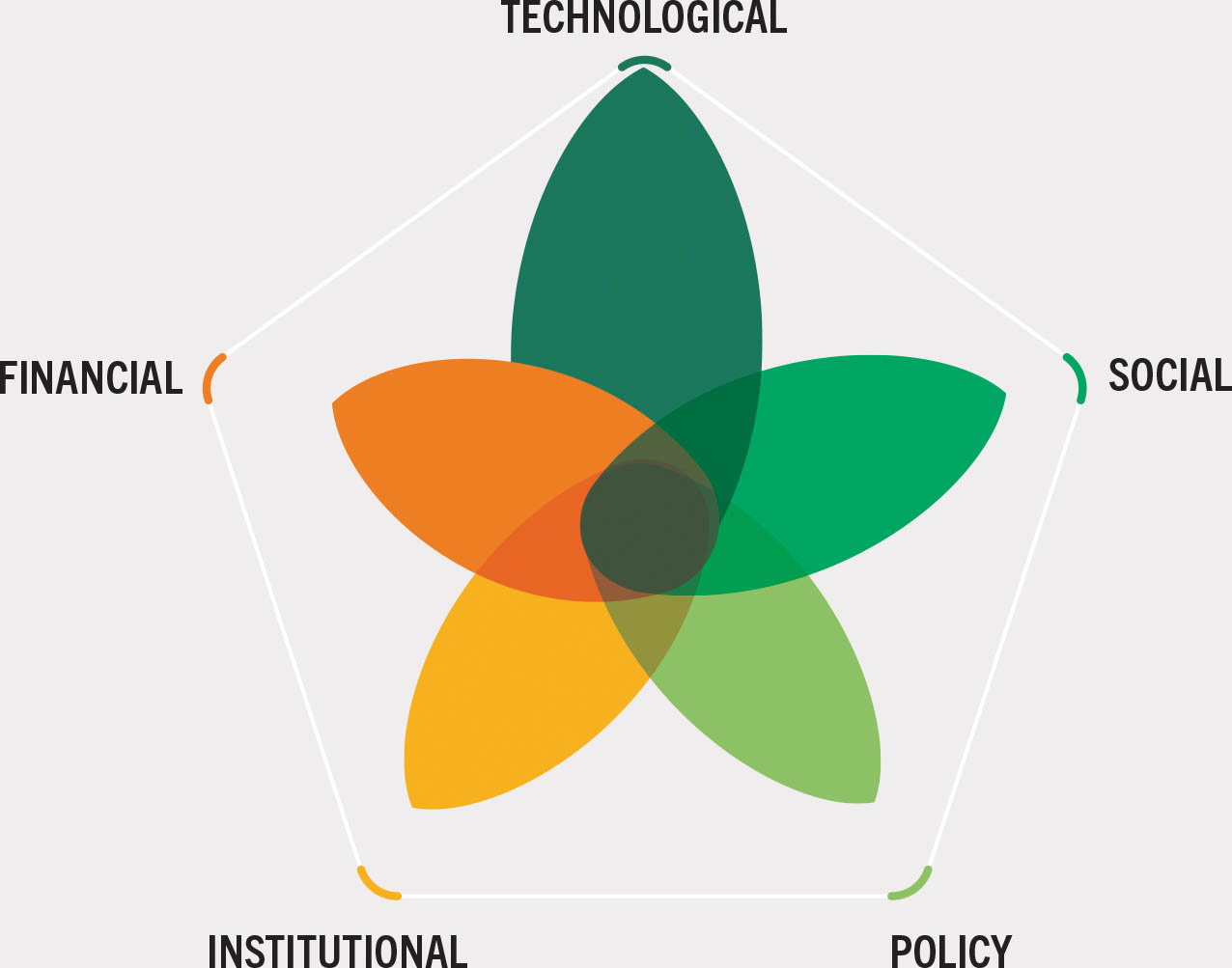
The context. The lack of coordination among land-use sectors and stakeholders has hindered efforts to balance forest-related and agricultural goals at the landscape and national scales. In Nigeria, the production of valuable agricultural crops such as cocoa and palm oil has led to serious environmental degradation, including deforestation and a reduction in ecosystem services. In Kenya, the Mount Elgon water-tower landscapes, which are crucial for sustaining local economies and livelihoods, are under threat from agricultural expansion, illegal logging and other human-induced pressures. Integrated landscape approaches linked closely to national policy development and action are helping improve multistakeholder governance mechanisms for solving these and other shared problems. They are also providing opportunities to reduce trade-offs and increase synergies between agriculture and forestry.
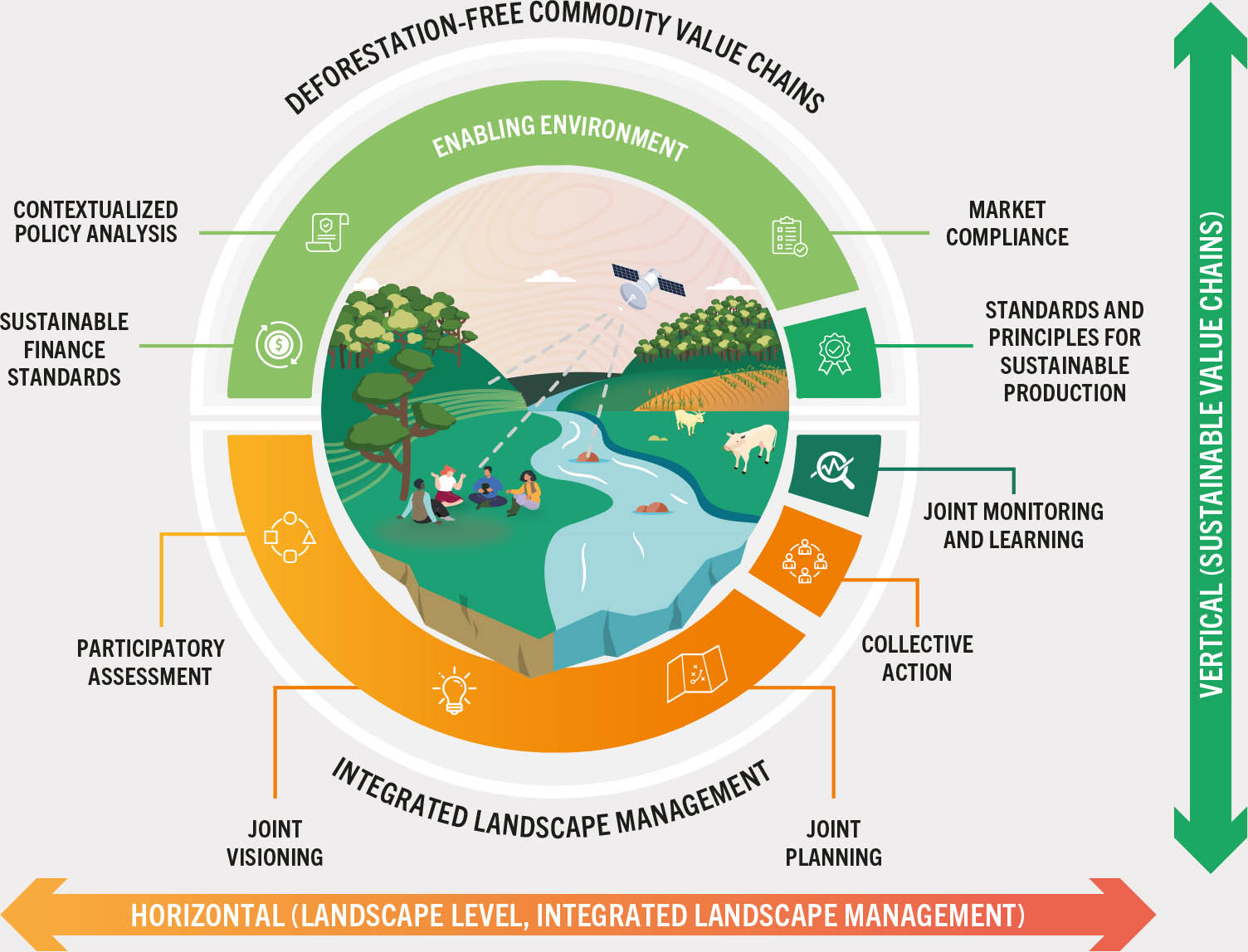
The innovation. New methods of internal organization and collaboration are required to achieve long-term sustainable solutions to complex challenges like agriculture-driven deforestation. FAO’s Participatory Informed Landscape Approach (PILA) demonstrates how the principles of cross-sectoral collaboration can be embodied in the design and implementation of interventions to improve outcomes on the ground. PILA is a guided, structured and tailored approach that brings together a complementary suite of FAO’s state-of-the art tools and methodologies to support integrated landscape management for informed decision-making. Under PILA, countries obtain technical support and expertise from the realms of forestry, crop and livestock production, land and water resources, geospatial data, transformative governance, tenure, finance and multistakeholder processes. By building technical and institutional country capacity, PILA supports landscape stakeholders (including governments and producer organizations) in planning their landscape management in an integrated, inclusive and fit-for-purpose way. Through holistic landscape assessment, PILA captures trustworthy data from household surveys and satellite imagery, working cross-sectorally to ensure better-informed and more-integrated decision-making.
PILA represents an organizational and cultural shift in FAO’s provision of support for countries on two fronts. First, it emphasizes inclusiveness throughout the process while enhancing system-wide national capacity to foster country ownership and commitment. Second, it includes and integrates all relevant sectors (e.g. agriculture, environment and planning) at the national level and across FAO technical divisions. Moreover, PILA connects landscapes to national processes by empowering producer organizations to develop their capacities and access new markets and sustainable finance to promote deforestation-free and inclusive commodity value chains, thereby building momentum to achieve desired impacts at scale (Figure 7).
Figure 7A schematic of the Participatory Informed Landscape Approach
Results and impacts. PILA is being piloted in Kenya and Nigeria under the GEF-7 Impact Program on Food Systems, Land Use and Restoration (FOLUR) to foster greater cross-sectoral collaboration in developing and implementing integrated and inclusive landscape management plans. In Kenya, ecosystem restoration and community-based natural resource management in the Mount Elgon water-tower landscapes will be enhanced through integrated participatory planning processes that are strengthening the involvement of local communities in evidence-based decision-making. To enable the landscape visioning exercise and the co-development of sustainable transition pathways, stakeholders require a clear understanding of existing (and future) opportunities in their landscapes for more sustainable production, management, conservation and restoration practices. The application of PILA is also improving the mapping of Kenya’s restoration potential (identifying areas where ecosystem restoration is biophysically suitable and most cost-effective) by integrating field data in a geospatial model developed using FAO’s Open Foris suite.76 In Nigeria, PILA is enhancing state-level and local government capacity in integrated geospatial analysis and, in close collaboration with state-level REDD+ units, improving access to high-quality spatial data for better-informed integrated landscape management.
Potential for scaling up. Using a programmatic approach, 25 FOLUR country projects in four regions are expected to strengthen national frameworks for integrated landscape management. PILA is providing innovative support for integrated landscape management targets and their scaling up to the national level. It can be applied across landscapes, commodities and food systems in a demand-based manner, especially addressing agriculture–forestry linkages. The aim is to transfer successes to other countries. PILA could also be replicated in other existing programmes (e.g. the World Bank’s Global Partnership for Sustainable and Resilient Landscapes and the GEF-8 Food Systems Integrated Program) that are supporting countries in their integrated land-management and planning processes, guiding the transition towards more diversified and sustainable value chains.
Case study 2Using new data on the role of forests in agricultural productivity to finance conservation on an agricultural frontier
Location: Brazil
Partners: Woodwell Climate Research Center, Amazon Environmental Research Institute
WEIGHTING OF INNOVATION TYPES
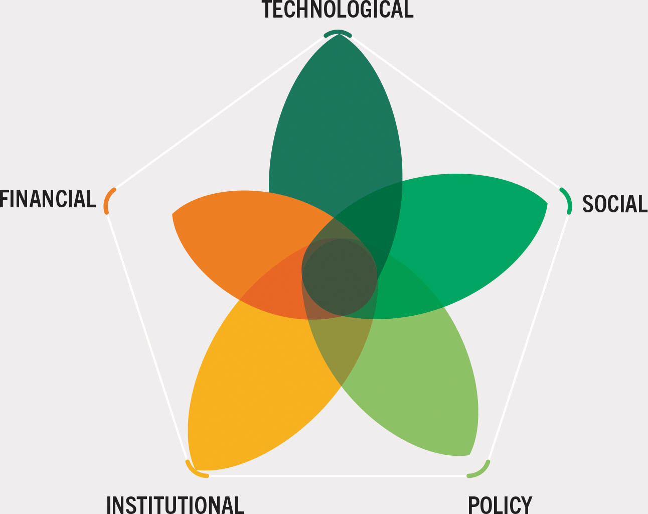
The context. More than 13 percent of Brazil’s Amazon–Cerrado Region (ACR, the region comprising the confluence of the Amazon and Cerrado biomes) was cleared for agriculture between 1985 and 2022, including the loss of 5.18 million ha of forests and woodlands.196 Commodity production plays a vital role in the Brazilian economy: in 2022, for example, record soybean harvests197 resulted in a 2.9 percent increase in the country’s gross domestic product, with associated increases in export revenues. Conversely, deforestation caused by increasing commodity production leads to rises in local temperature and higher vapour pressure deficits, which ultimately reduce crop yields (Figure 8).198 On average, the percentage of forest cover in the ACR explains 30 percent of the differences in soybean yields across different landscapes due to the cooling benefits provided by forests. Moreover, deforestation reduces the resilience of agricultural crops and livestock during heatwaves and prolonged dry spells – thus, despite an increase in the area under agriculture, overall production may decrease, outweighing any fleeting advantages of deforestation and jeopardizing the long-term goal of enhancing agricultural productivity.198
Figure 8Deforestation in the Amazon–Cerrado Region affecting vapour pressure deficit and mean temperature in landscapes with differing levels of agricultural intensification, over a calendar year
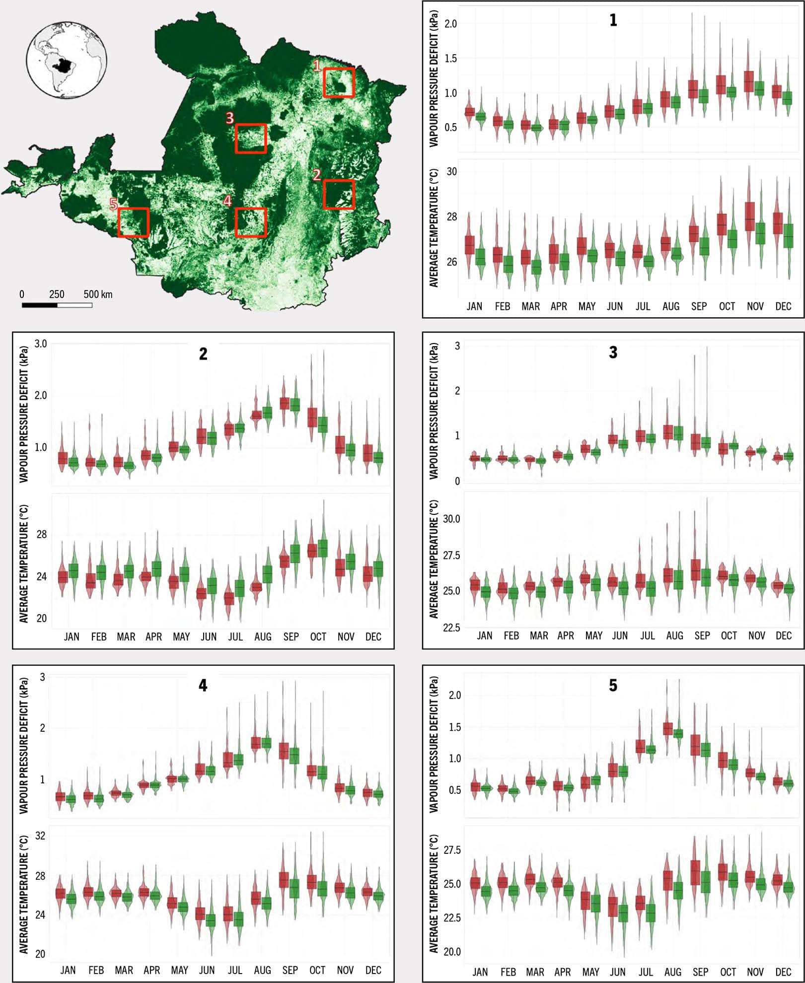
SOURCE: Case-study authors’ own elaboration; (map) MapBiomas Project. 2024. Collection 8 of the Annual Series of Coverage and Land Use Maps of Brazil. In: MapBiomas Brazil. https://doi.org/10.58053/MapBiomas/VJIJCL and Climatology Lab. 2024. Terraclimate. [Accessed on 14 June 2024]. https://www.climatologylab.org/terraclimate.html Licence: CC0 1.0 UNIVERSAL.
Given the increased intensity of extreme weather events,199 the benefits of retaining remaining forests in heavily cultivated Amazonian and Cerrado production landscapes are becoming clearer. Economic incentives for forest retention are available, such as the Brazilian government’s ecological value-added tax (ICMS) and international REDD+ results-based payments,200 but more are needed to prevent further deforestation and to support production intensification in already-developed areas.
The innovation. Digital innovations are helping advance understanding in Brazil of the benefits of forests (beyond carbon storage and sequestration) for buffering climatic extremes, including MODIS products such as Land Surface Temperature and Evapotranspiration, TerraClimate’s monthly climatic water balance data for global terrestrial surfaces, and MapBiomas’s land-use and land-cover data. Tools such as Google Earth Engine and new R packages are facilitating the processing and analysis of the huge volumes of data required for these insights. For example, new digital products have made it possible to determine that regions in the Brazilian Amazon with forested Indigenous territories experience temperatures that are, on average, 2 °C cooler than unprotected areas that are subject to higher deforestation rates.201
Results and impacts. The increased knowledge derived from the new digital products makes it possible to better design landscapes that maximize climate resilience and agricultural productivity, for example by indicating the area of forest needed to regulate climate for optimum agricultural production and to ensure connectivity between forest areas to ensure biodiversity conservation. Advances in knowledge and tools are enabling better compliance with environmental laws such as Cotas de Reserva Ambiental (Environmental Reserve Quotas) and Lei para Proteção da Vegetação Nativa (Native Vegetation Protection Law).
Initiatives like the CONSERV project, which is led by the Amazon Environmental Research Institute, are leveraging mapping capabilities to identify native vegetation surpluses, thereby offering incentives for rural producers to protect forests on their land. CONSERV uses various techniques, such as incorporating technological innovations, providing financial incentives, and enforcing effective mechanisms to prioritize forest conservation in sustainable production practices. To date, it has enabled protection of about 21 000 ha on 23 private properties, potentially averting 2.2 million tonnes of carbon-dioxide emissions. In the past, monitoring environmental restrictions mandated by law was a bottleneck in the nationwide Cotas de Reserva Ambiental system.202 With the improved technology, however, it is now possible to prioritize areas to maximize local-level climate-change mitigation.
Potential for scaling up. Estimating the value of forests for agricultural production can create new income streams for landowners with potential to cover the opportunity costs of not opening up new forest areas to agriculture. International financial mechanisms will be needed to scale up such schemes beyond Brazil, however, because many benefits of forest ecosystem services extend beyond national boundaries. The process requires a revenue source, which could be based on the user-pays principle, and a process to verify forest conservation. Enforcement is also essential: there would be no demand and subsequently no market without government regulation, the oversight of financial institutions, and supply-chain pressures to enforce landowner compliance. Safeguarding standing forests is crucial for sustainable agricultural systems and needs to be recognized and valued.
Case study 3Harnessing the power of partnership and technical innovation to reduce commodity-driven forest loss
Location: Ghana
Partners: FAO, World Resources Institute, Google, National Aeronautics and Space Administration (NASA), Unilever, United States Agency for International Development, United States Department of State
WEIGHTING OF INNOVATION TYPES
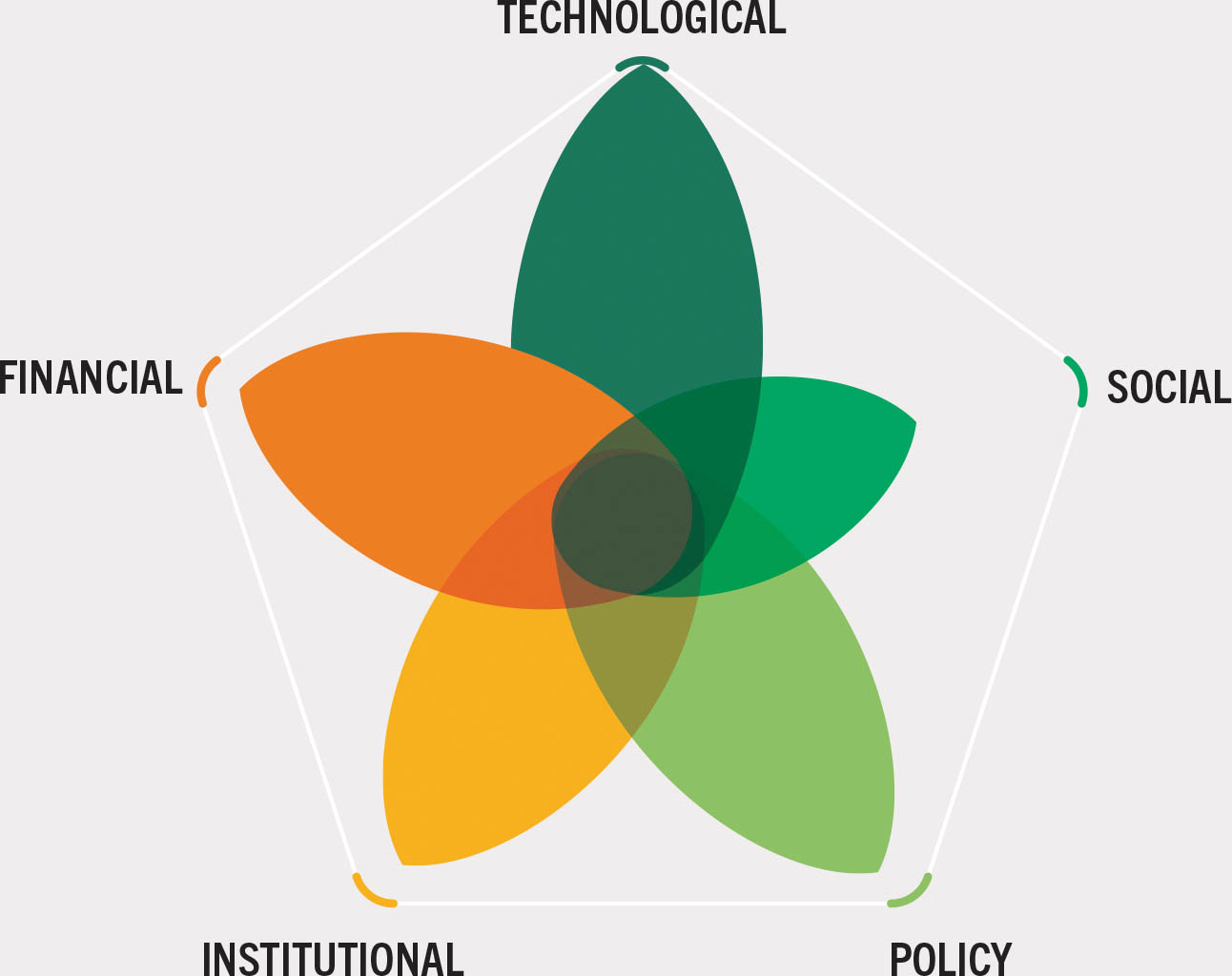
The context. Deforestation has declined in recent decades, but the challenge remains to produce commodities such as palm oil, cocoa, soy and beef sustainably. Recognizing this, regulations on products from deforestation-free supply chains have come into force, such as the European Union regulation on deforestation-free and forest-degradation-free supply chains (known as the EUDR). Improving land-use monitoring and the tracking of commodity supply chains are necessary steps for understanding the impacts of commodities on forests, supporting the design and implementation of effective solutions to address forest loss, and making agricultural production and food systems more sustainable. Regulations such as the EUDR have major implications for commodity producers: in Ghana, for example, cocoa producers may lack access to the technical solutions and data required for compliance.
The aim of the Forest Data Partnership (hereafter “the Partnership”) is to ensure access for all stakeholders to consistent, validated, open-source geospatial forest-risk commodity data. Smallholder farmers and Indigenous Peoples – the groups most vulnerable to the requirements of emerging regulations – are especially in need of fit-for-purpose technical solutions (for geolocation) to demonstrate compliance. As part of the Digital Public Good Alliance, FAO is leading the Partnership’s innovation workstream on digital public solutions for forest and commodity monitoring.
The innovation. The Partnership has joined forces with the Linux Foundation within the framework of the Sustainable Agriculture for Forest Ecosystems flagship of the Team Europe Initiative Zero-Deforestation hub to develop and deploy free, open-source digital solutions that are compliant with deforestation-free regulations. The Partnership is taking a structural convergence-of-evidence approach aimed at enabling compliance for all producers based on the principles of accessibility, inclusiveness, comparability and interoperability.
The convergence-of-evidence approach streamlines access to analysis-ready data on forests, commodities and land-use change at any scale for all producers, thereby enabling them to generate the data they need to comply with zero-deforestation regulations. It comprises the following building blocks:
▸ the Open Foris Ground application, co-developed by Google and FAO, to enable users to geolocate or delineate their farm boundaries;
▸ an asset registry (developed by AgStack of the Linux Foundation), which is a free, addressable and non-discoverable public registry of field/farm boundaries without any other attributions (i.e. fields are anonymous and do not carry personal or any other information); and
▸ a data pipeline that enables users to fetch publicly available geospatial and temporal data such as land-cover change and land-use layers for a given plot of land, implemented in different digital public goods of the Open Foris suite to assist countries in monitoring and reporting on forests and land use.
Results and impacts. A focus area of the Partnership is cocoa in Ghana, and early outcomes include the development of data baselines and pathways for cocoa linked to deforestation. The approach is being field-tested in Ghana and at the regional NASA-SERVIR hub for West Africa (a partnership between regional organizations building capacities to help countries use information provided by Earth-observing satellites and geospatial technologies). The result is credible, systematic monitoring, verification and accountability towards reducing cocoa-driven deforestation. The processing environment is being made available publicly, and the Government of Ghana is using it to support cocoa producers in providing evidence for EUDR zero-deforestation claims on their farms.
Potential for scaling up. The geospatial data ecosystem made available by the Partnership can be adapted to other commodities and other countries and regions. In addition, data-sharing protocols and geolocation standards produced under the Partnership are regulation agnostic and can be adopted for other uses. FAO is providing similar technical support to Peru and Viet Nam under the Accelerating Innovative Monitoring for Forests (AIM4Forests)203 programme, leveraging technical innovations developed under the Partnership. Support under AIM4Forests is increasing in 2024, also in light of emerging deforestation-free regulations in the United Kingdom of Great Britain and Northern Ireland and the United States of America. More broadly, the Partnership has potential to catalyse major change through its technical solutions by harnessing the collective reach of United Nations (UN) agencies, large civil-society organizations, and major data and technology companies.
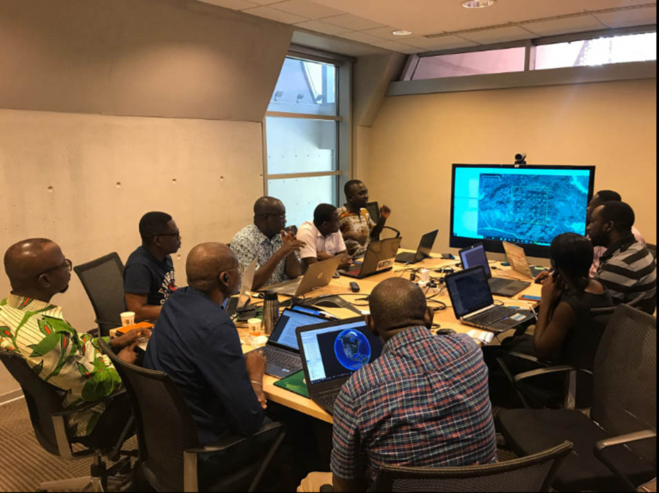
© FAO/Frank Owusu
Case study 4Building new tools and techniques into existing community forest management models to enhance forest outcomes
Location: Colombia
Partners: FAO, Ministry of Environment and Sustainable Development (MinAmbiente) (Colombia), subnational environmental authorities, community organizations
WEIGHTING OF INNOVATION TYPES
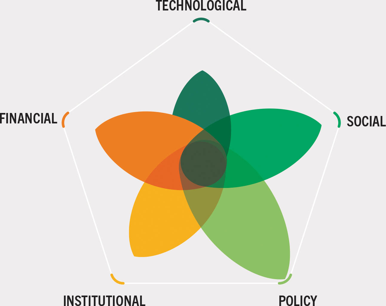
The context. In Colombia, Indigenous-Peoples- and community-managed land and forests comprise about 53 percent of the total land area in the form of Indigenous reserves, zonas de reserve campesinas (“peasants’ places”) and Consejos Comunitarios de Comunidades Afrocolombianas (“community councils of Afro-Colombian people”). These lands are important for the conservation of both biodiversity and cultures, as well as for carbon storage and water management. Community forest management (CFM) has been practised in Colombia for several decades, but persistent challenges have hampered its effectiveness, including lengthy and uncoordinated local bureaucratic procedures, little understanding of regulations and a lack of sustainable finance.
The innovation. New enabling policies and strategic collaboration have helped revitalize community forest enterprises and strengthen forest governance. Colombia’s implementation of a new CFM model is focusing on collaborative governance as a means for reducing emissions from deforestation and forest degradation and contributing to climate action.
A key element of the new CFM model is the forest management and deforestation control strategy, Bosques Territorios de Vida (“Forests – Territories of Life”), developed by MinAmbiente. The strategy was developed using an integrated approach to determine whether novel forest governance approaches could simultaneously halt deforestation, address climate change, contribute to rural sustainable development and manage trade-offs between agriculture and forestry. This required collaboration across ministries (including agriculture), regional environmental authorities, academia, the private sector, Indigenous Peoples and non-governmental organizations. The use of different activities to move towards CFM (e.g. use of timber and non-timber products, financial incentives, establishment of nurseries, agroforestry systems and restoration actions) has allowed partners and external stakeholders to understand that landscape-level interventions can quickly generate real and impactful social, ecological and economic results. Bosques Territorios de Vida involves lines of action focused on recognizing the governance of Indigenous Peoples and of local communities and their traditional practices related to sustainable forest management; promoting and consolidating the forest value chains; and “associativity”.w
Additional efforts have helped strengthen CFM. In the formulation of the national REDD+ strategy (known as ENREDD+), for example, consultations with community stakeholders demonstrated the potential benefits of incorporating community forestry as a mechanism for meeting the country’s climate goals. Integrating it into the system of financial incentives and results-based payments under ENREDD+ has helped provide a more sustainable funding base for CFM; it has also helped improve community-based forest monitoring and increase market access for community forest enterprises.
Other innovative approaches to securing more sustainable sources of funding for CFM include the adoption of the Market Analysis and Development methodology and the intervention logic of the FFF; incorporation of a gender and generational approach; the provision of technical assistance by a multidisciplinary team at each community forestry pilot site; and the contracting of local community organizations to provide logistical and technical services for project activities.
Results and impacts. The knowledge gained from implementing CFM through pilots has improved coordination between forestry and agriculture, which, in turn, has helped improve quality of life for people in rural areas, enabled advances towards the country’s climate goals, and increased connectivity among forest areas.
Putting the new CFM model in place has enabled progress towards the implementation of ENREDD+ and compliance with forest laws related to the legal access and use of timber and NTFPs; it has also strengthened the capacity of communities to process and obtain use permits and authorizations issued by the respective regional autonomous authorities. The approach has led to the formal recognition of CFM as a crucial tool for achieving goals on forest conservation, climate-change mitigation and community well-being and encouraged the incorporation of gender and youth perspectives into the design of forest plans and management. Given the importance of CFM for the livelihoods of Indigenous Peoples and Afro-Colombian and local communities, its formal recognition in a policy framework has helped legitimize and make visible the key role of traditional knowledge in forest conservation.
The strategy has enabled new partnerships between community forest enterprises and private-sector intermediaries, with the effect of lowering the cost of market entry for community forestry producers and strengthening the viability of their enterprises, leading to increases in incomes and creating new avenues for forest-based livelihoods. Various cooperation organizations, non-governmental organizations and private enterprises have collaborated under the leadership of MinAmbiente. At the beginning of the process, collective harvesting permits for peasant territories were not widespread, despite being a provision in Colombian law, but successful cases have emerged with the implementation of the CFM model. The most recent national development plan, through Law 2294 of 2023, reaffirms peasant forest concessions in Article 49, creating an opportunity for the implementation of CFM in regions where this was previously unthinkable. The model is being implemented in 12 departments (in which deforestation is prevalent and community forestry has long been practised) and at least 30 CFM initiatives are in operation, mostly in the Amazon. At the national level, some 271 000 ha are subject to CFM, involving the participation of nearly 3 400 families among Indigenous Peoples, peasant communities and Afro-descendants.
Potential for scaling up. The CFM model developed as part of the Bosques Territorios de Vida strategy is promising, thanks in part to its inherent adaptability, Colombia’s extensive forest resources, and the presence of collective territories with capacity for forest governance. The adaptability and replicability of the model were demonstrated when it scaled up from four pilots in four departments in 2018 to 30 initiatives in 12 departments in 2023.
The model has considerable potential for community development while helping safeguard natural resources; it can contribute to the fight against climate change and biodiversity loss while enhancing food security and sustainable development. The model has a crucial role to play in the country’s Amazon Deforestation Containment Plan.
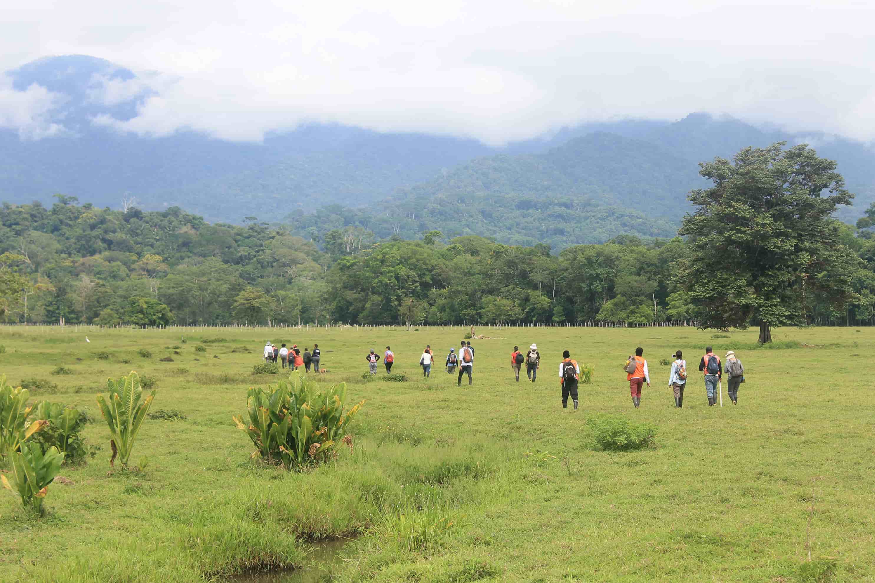
© UN-REDD Programme
Case study 5Technical innovation, capacity building and financing to support Indigenous Peoples as forest custodians
Location: Global
Partners: International Land Coalition, World Resources Institute, members of the LandMark steering group, comprising Indigenous Peoples’ Alliance of Nusantara, Asia Indigenous People’s Pact, Centre for Sustainable Development and Environment, Coordinating Body of Indigenous Organizations of the Amazon Basin, also representing Global Alliance of Territorial Communities, Ogiek Peoples’ Development Programme, Programme intégré pour le développement du peuple pygmée au Kivu, also representing Réseau des Peuples Autochtones et Communautés Locales pour la gestion durables des écosystèmes forestiers d’Afrique, Rights and Resources Initiative, World Alliance of Mobile Indigenous Peoples
WEIGHTING OF INNOVATION TYPES
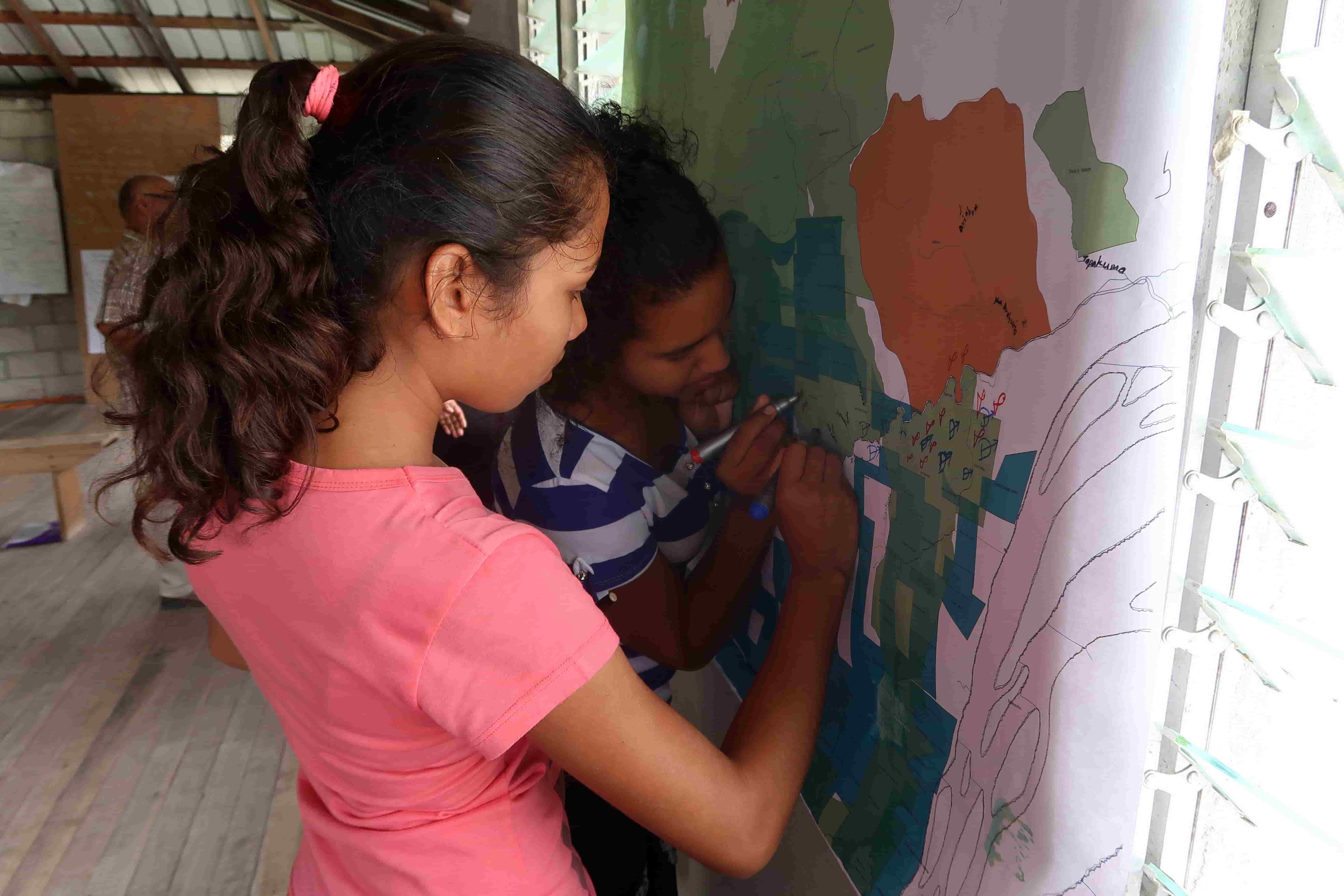
The context. There is increasing awareness of the key role of Indigenous Peoples as the most effective custodians of vast areas of forest.204, 205 Pressures and threats to these forest lands and territories are increasing, however, with the expansion of agroextractive activities and infrastructure development. Given their outsized role in biodiversity conservation and climate-change mitigation and adaptation, it is essential that Indigenous Peoples have the human, legal and technical resources to continue their efforts to protect and restore forests, but they remain largely excluded from decisions regarding their territories. Limited technical knowledge and capacity, the lack of legal frameworks recognizing their land and carbon rights, underfunding, and inadequate benefit-sharing and free, prior and informed consent processes present key risks and barriers to the participation of Indigenous Peoples in forest policy mechanisms and emerging opportunities for climate finance.
The innovation. The AIM4Forests203 programme will deploy innovative technologies alongside technical solutions for Indigenous Peoples in gaining recognition of their territories, improving their forest monitoring capabilities and enabling their engagement in emerging climate finance opportunities. By working with the Global Platform of Indigenous and Community Land, called LandMark,x and Indigenous Peoples-led communities-of-practice, AIM4Forests will also foster bottom-up and peer-to-peer learning and knowledge generation, thus helping enable Indigenous Peoples to harness innovative technologies and develop pathways for increasing their participation in global efforts for biodiversity conservation and climate-change mitigation and adaptation.
Results and impacts. AIM4Forests, which began only recently, is helping Indigenous Peoples in their efforts to conduct their own territorial mapping and forest monitoring and to develop their own data and capacity to seek land-tenure recognition and tap into climate-related financing opportunities. This will both strengthen the rights of Indigenous Peoples as stewards of forests and other resources and enable more inclusive, equitable and sustainable benefit-sharing. The increase in mapping and monitoring capacity will ultimately strengthen the position of Indigenous Peoples in claiming results-based payments from conservation and sustainable forest management activities in their territories and the carbon credits to which they are entitled. For example, as of September 2023, 26 governments had submitted eligible carbon finance proposals to the Lowering Emissions by Accelerating Forest Finance (LEAF) Coalition,y but only one of these (from the Plurinational State of Bolivia) concerned a recognized Indigenous territory. It is important to ensure that Indigenous Peoples are well placed to participate in climate finance if interested and to obtain a fair share of the benefits.
Potential for scaling up. Although Indigenous Peoples own or manage one-quarter of the world’s lands, their territorial rights continue to be unrecognized in many parts of the world.206 The empowerment of Indigenous Peoples through the mapping of their lands and collection of high-quality data can help increase the visibility of Indigenous territories and support efforts to secure land rights, which is one of the best and most cost-effective ways to prevent deforestation and reduce biodiversity loss and carbon emissions. There is potential to strengthen and replicate Indigenous Peoples-led mapping and monitoring initiatives over vast areas through this project,203 which can form a basis for their participation in climate financing.
© FAO/Amerindian People’s Association
Case study 6Integrating science, technology and traditional knowledge to improve fire management decision-making
Location: Global in concept, piloting in Southeast Asia
Partners: Global Fire Management Hub partners, Korea Forest Service, German Federal Ministry for Food and Agriculture
WEIGHTING OF INNOVATION TYPES
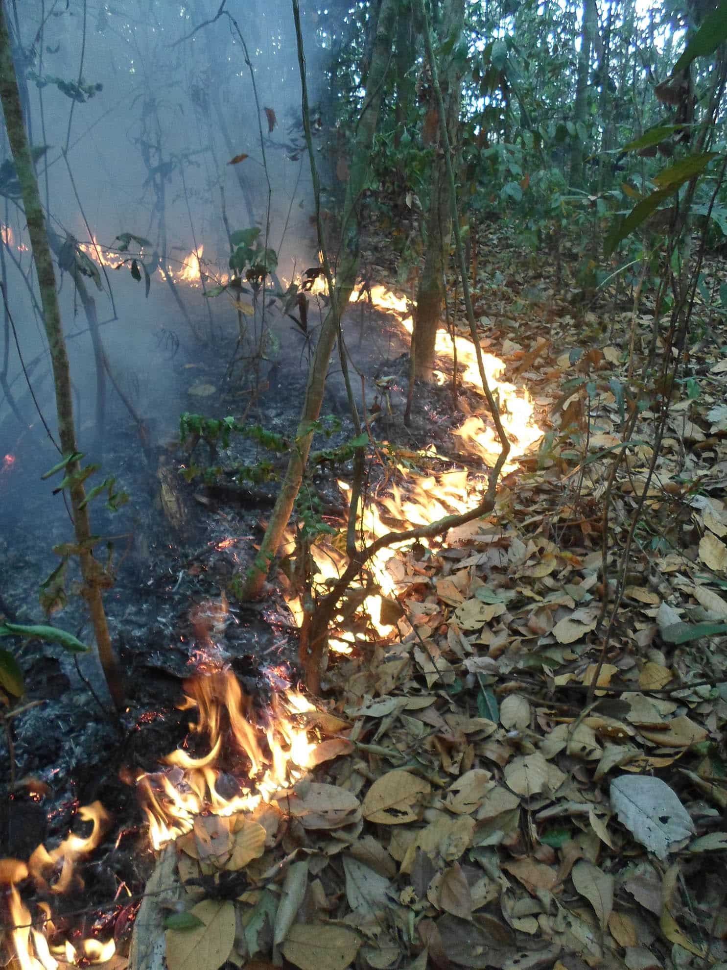
The context. Wildfires are burning longer and with greater severity in forests, peatlands and permafrost regions, and the length of fire seasons is increasing in many parts of the world. 34 Climate change and land-use change are projected to make wildfires more frequent and intense, 34 and there is a need, therefore, to invest more in wildfire prevention and preparedness. The many negative impacts of wildfire disproportionately affect the poorest, who have the least capacity to adapt to changed fire regimes. Contemporary fire management and decision-aid tools are often based on new technologies and fire science, but they may lack adequate consideration of the importance of fire as a land-management tool, especially in the Global South, and they may fail to incorporate the vast fire management knowledge held in Indigenous and other traditional communities.
The innovation. The Global Fire Management Hub,z led by FAO and partners, is supporting communities and countries in their efforts to develop local-level fire management decision-aid tools that integrate traditional and scientific knowledge and the latest technologies aimed at reducing the negative impacts of wildfires on livelihoods, landscapes and climate. The innovation is based on the premise that fire problems that affect communities require community-led solutions. It provides a procedure for quantitatively integrating fire science and traditional fire knowledge – thereby “walking on two legs”, as some Indigenous leaders put it.
The fire management decision-aid tools under development are based on:
▸ models – the existing fire-danger-rating and early-warning systems;
▸ data – the latest information on fire weather, climate, fire activity, and fuels and vegetation; and
▸ knowledge – incorporating Indigenous, cultural and traditional fire management knowledge and expertise.
Fire management decision aids are being constructed for wildfire management (prevention, detection and pre-suppression) and prescribed-burn planning, including traditional and Indigenous fire use. They are linked directly to fire behaviour, which is estimated using physical models quantified by fuel consumption and rate of spread, based on fire weather and vegetation data (this measure of the potential for fire to start, spread and cause damage is the product of a fire-danger rating system). A fire early-warning system delivers knowledge of future fire-danger conditions and provides an input to planning and decision-making, weeks and even months ahead of the fire season; it can incorporate drought indices, local traditional knowledge of weather systems and trends, and climatic influences. The tools are being co-developed with local communities based on their fire knowledge and best practices. The approach is being piloted in Southeast Asia in the context of the Assuring the Future of Forests with Integrated Risk Management mechanism.
Results and impacts. People can be empowered by new fire management decision-aid tools that combine modern science and technology with the fire management knowledge, expertise and needs of local communities and Indigenous Peoples. These tools can enable local fire managers to use fire-danger and early-warning information to anticipate and prepare for wildfire threats and to plan and safely conduct traditional burning practices. Communities may be able to implement integrated fire plans in advance of extreme fire-danger conditions, including for prescribed burns aimed at achieving traditional fire and land management goals.
Potential for scaling up. The innovative fire management decision aids developed will provide a blueprint for national fire agencies and similar activities worldwide, a methodology for integrating fire science and traditional knowledge, and examples of community-based fire management decision aids. The outputs will be integrated into the Global Fire Management Hub, which is receiving broad international support as a way to strengthen country capacities for integrated fire management, including through a focus on communities, thus ensuring wide outreach and uptake.
© FAO/Brett Shields
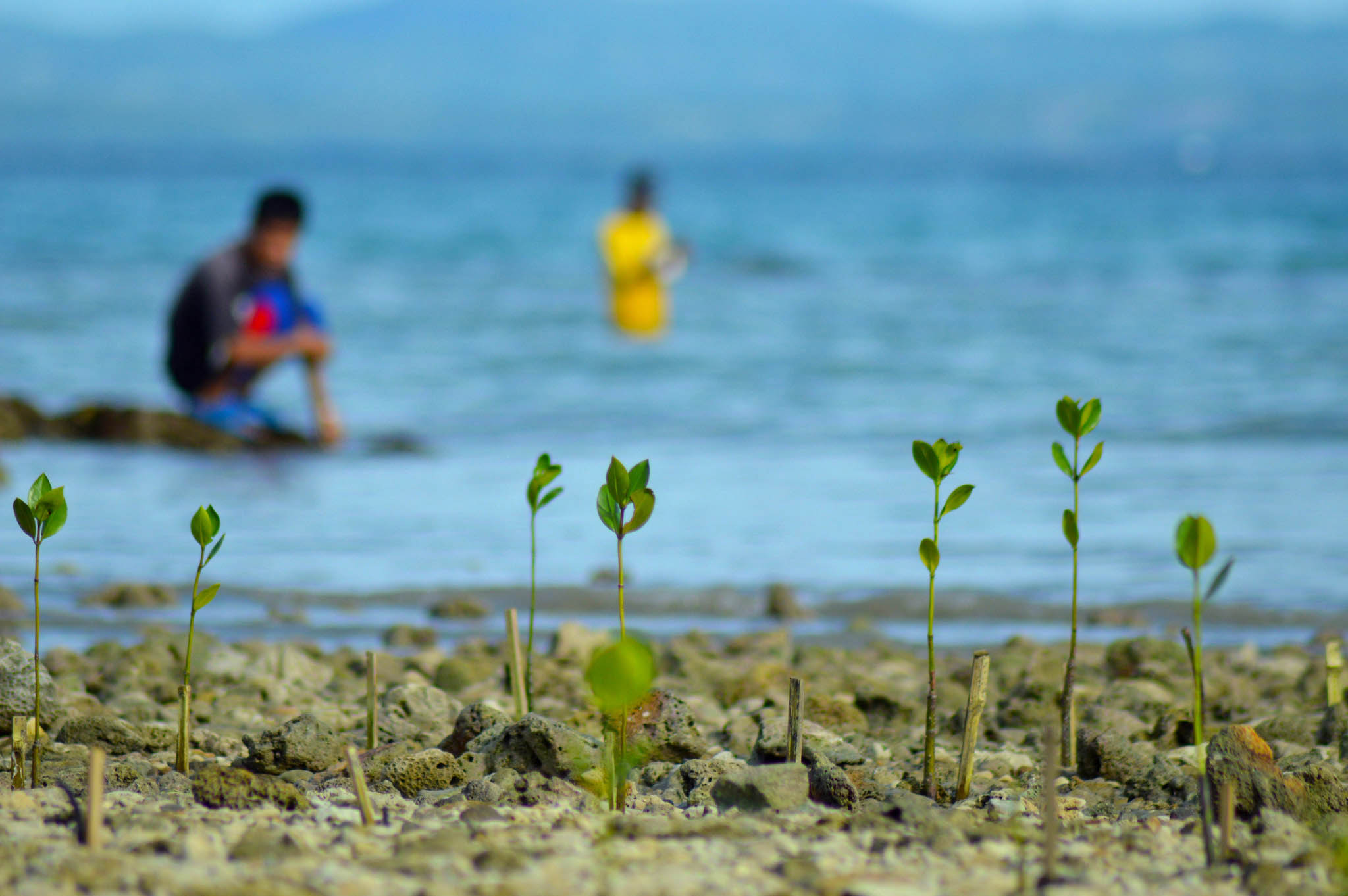
Planting mangroves increases the resilience of coastal communities.
© FAO/Benjo Salvatierra


